Podcast
Questions and Answers
What type of information do geological maps typically display?
What type of information do geological maps typically display?
- Rock types and geological formations (correct)
- Distribution of population density
- Road, rail, and air networks
- Temperature and precipitation data
How do GIS and maps aid in disaster management?
How do GIS and maps aid in disaster management?
- By showing transportation networks
- By quickly identifying and responding to hazards (correct)
- By providing climate data
- By displaying population density distribution
What is one of the popular types of maps that help in understanding human settlement patterns?
What is one of the popular types of maps that help in understanding human settlement patterns?
- Transportation maps
- Topographic maps
- Population maps (correct)
- Geological maps
Flashcards
GIS definition
GIS definition
A computer tool for analyzing, visualizing, and understanding geographic data.
Map type: Topographic
Map type: Topographic
Shows terrain features like hills, valleys, and water bodies.
GIS Use in Disaster Management
GIS Use in Disaster Management
GIS helps locate people, buildings, and infrastructure to respond to disasters quickly and efficiently.
Study Notes
Geography: Exploring Geographic Information Systems (GIS) and Maps
Geography, the scientific study of our planet and its natural and human-made features, has evolved significantly with the advent of technology. Among the most transformative tools in this domain are Geographic Information Systems (GIS) and the maps they generate. Let's delve into these fascinating subtopics of geography.
Geographic Information Systems (GIS)
GIS is a computer-based tool that enables geospatial data analysis, visualization, and inference. It combines and processes geographic data with other relevant data, such as demographic, economic, and environmental information, to provide valuable insights. GIS allows geographers and other professionals to answer complex questions and make informed decisions related to their areas of interest.
Some of the key features of GIS include:
- Data analysis: GIS enables users to analyze patterns and relationships within their data sets, such as predicting population growth or the spread of diseases.
- Data visualization: GIS provides a flexible platform for displaying and visualizing data, such as maps, charts, and graphs, to better communicate findings and insights.
- Data management: GIS allows users to store, organize, and manage their geospatial data effectively.
- Data modeling: GIS facilitates the creation of models to simulate real-world scenarios, such as natural disasters or urban development.
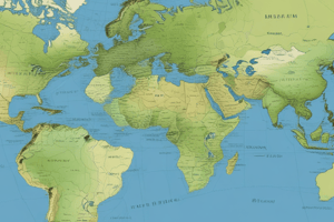
Maps
Maps are one of the most prominent outputs of GIS. They provide a visual representation of geographic data, helping users to understand the spatial relationships between different features. Maps can be created using various data sources, such as remote sensing data, survey data, and georeferenced images.
Some popular types of maps include:
- Topographic maps: These maps provide detailed information about terrain features, such as hills, valleys, and water bodies.
- Geological maps: These maps display information about the rock types and geological formations of an area.
- Climate maps: These maps depict global or regional climate conditions, such as temperature and precipitation.
- Population maps: These maps display the distribution of population density, helping to understand human settlement patterns.
- Transportation maps: These maps show the road, rail, and air networks of an area, along with related facilities such as airports and train stations.
Maps can be created using various technologies, including digital cameras, satellites, and drones. These maps can be viewed using traditional media, such as paper maps and globes, or in digital formats, such as GIS software and web-based applications.
Example: GIS and Maps in Action
A common example of GIS and maps in action is disaster management. Geographers and emergency responders can use GIS to create maps that display the locations of people, buildings, and critical infrastructure. These maps help them to quickly identify and respond to potential hazards, such as floods or earthquakes, and to allocate resources effectively.
In conclusion, geographic information systems (GIS) and maps are powerful tools that enable geographers and other professionals to better understand the world around them. They provide valuable insights into spatial relationships, patterns, and trends, helping to inform decisions and improve our quality of life.
By utilizing GIS and maps, we can gain a deeper understanding of our planet's natural and human-made features, and help to create a more sustainable and resilient world.
Studying That Suits You
Use AI to generate personalized quizzes and flashcards to suit your learning preferences.