Podcast
Questions and Answers
What element of a map identifies its subject?
What element of a map identifies its subject?
- Grid
- Legend
- Title (correct)
- Scale
Which element of a map helps in determining distances?
Which element of a map helps in determining distances?
- Legend
- North line
- Scale (correct)
- Grid
What do horizontal lines on a map represent?
What do horizontal lines on a map represent?
- Northings (correct)
- Eastings
- Longitudes
- Scales
Which of the following is NOT an advantage of maps?
Which of the following is NOT an advantage of maps?
What purpose does the North line on a map serve?
What purpose does the North line on a map serve?
Which element of a map provides the unique number for pinpointing locations?
Which element of a map provides the unique number for pinpointing locations?
How do maps assist in organization of information?
How do maps assist in organization of information?
Which of the following is an example of a disadvantage of maps?
Which of the following is an example of a disadvantage of maps?
What are point symbols used to represent on a map?
What are point symbols used to represent on a map?
Which color on a map typically denotes water bodies?
Which color on a map typically denotes water bodies?
What is the term for a small river that flows into a larger river?
What is the term for a small river that flows into a larger river?
Which of the following describes the features of a delta?
Which of the following describes the features of a delta?
What happens to a river as it flows through flat plains?
What happens to a river as it flows through flat plains?
What are anticlines in geological terms?
What are anticlines in geological terms?
Which feature is created when natural cracks or faults are present in the Earth's crust?
Which feature is created when natural cracks or faults are present in the Earth's crust?
What is a distributary?
What is a distributary?
Which type of symbol represents railways and roads on a map?
Which type of symbol represents railways and roads on a map?
What role do diagrams play in map representation?
What role do diagrams play in map representation?
What distinguishes a sketch from a map?
What distinguishes a sketch from a map?
Which of the following is true about a map scale?
Which of the following is true about a map scale?
What does a globe provide that a map does not?
What does a globe provide that a map does not?
Which of the following statements is true regarding a plan?
Which of the following statements is true regarding a plan?
Which of the following is an example of a small-scale map?
Which of the following is an example of a small-scale map?
How does the ratio scale work in a map?
How does the ratio scale work in a map?
What is not a characteristic of large-scale maps?
What is not a characteristic of large-scale maps?
Why is understanding cardinal directions important?
Why is understanding cardinal directions important?
What is a common use for a linear or graphic scale?
What is a common use for a linear or graphic scale?
Which of the following best defines the term 'conventional symbols' on a map?
Which of the following best defines the term 'conventional symbols' on a map?
Which statement accurately describes a small-scale map?
Which statement accurately describes a small-scale map?
What is the primary function of a scale in mapping?
What is the primary function of a scale in mapping?
What is an example of a feature that would be best represented in a detailed plan rather than a map?
What is an example of a feature that would be best represented in a detailed plan rather than a map?
Flashcards are hidden until you start studying
Study Notes
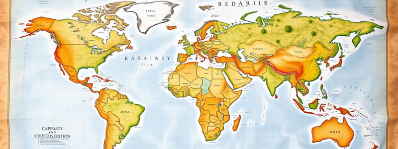
Maps Overview
- Maps are two-dimensional representations of the Earth's surface, showing land and water features.
- They simplify geographical information, allowing for understanding of distances, directions, and the shapes of countries.
Elements of a Map
- Title: Identifies the purpose of the map, usually found at the top.
- Legend: Explains symbols used, which can include shapes, colors, and lines.
- Scale: Shows the ratio of map distances to actual ground distances (e.g., 1 cm on the map equals 100 km).
- North Line: Indicates the North direction for orienting the map.
- Grid: Comprises horizontal (latitudes) and vertical (longitudes) lines, facilitating exact location pinpointing.
Advantages of Maps
- Portable, allowing for easy transport and use.
- Detailed representation of urban layouts and various geographical areas.
- More informative than globes, particularly for specific topographical information.
- Easily updated to reflect changes in physical or political landscapes.
- Useful for various professionals like sailors, pilots, engineers, and urban planners.
- Employed by governments for administrative, planning, and defense.
Importance of Maps
- Represent the real world on a reduced scale, aiding in navigation and travel.
- Organize geographical data, illustrating climate, agricultural products, and population dynamics.
Comparison of Maps, Sketches, Plans, and Globes
- Map: Scientific and scaled representation of Earth; shows details using symbols.
- Sketch: Rough, freehand representation highlighting main features without a scale.
- Plan: Detailed drawing of small areas with precise measurements, always using a large scale.
- Globe: Three-dimensional, accurate representation of the Earth’s shape and geography.
Differences Between Maps and Sketches
- Maps are scaled and scientifically drawn; sketches lack scale and precision.
Differences Between Maps and Plans
- Maps offer a broader view of regions without extensive detail; plans detail small areas comprehensively.
Differences Between Maps and Globes
- Maps can display all locations simultaneously but may distort shapes; globes accurately depict Earth's physical form.
Understanding Scale
- Scale conveys the relationship between map distance and actual ground distance.
- Displayed in various formats: statement scales, representative fractions, and linear scales.
- Example scale: 1:25,000 means 1 cm on a map corresponds to 25,000 cm in reality.
Types of Map Scales
- Small-Scale Maps: Cover large areas, showing limited detail (e.g., world maps).
- Large-Scale Maps: Focus on small areas, providing extensive details (e.g., city maps).
Directions and Cardinal Points
- Four main cardinal directions: North, East, South, West, with intermediate directions like Northeast and Southeast aiding navigation.
Conventional Symbols in Maps
- Standardized symbols allow easy interpretation of features such as roads, buildings, and water bodies.
- Point symbols for locations, line symbols for paths, and area symbols for land types are commonly used.
Representation of Geographical Features
- Diagrams illustrate features like rivers, meanders, tributaries, distributaries, and deltas.
- Meanders: Wide loops formed by slow-flowing rivers in flat areas.
- Tributaries: Smaller rivers flowing into larger rivers; distributaries diverge from a main river.
- Delta: A landform at a river's mouth made of silt deposits.
Geological Features
- Anticlines and Synclines: Folds in Earth's crust created through compression.
- Block Mountains: Formed by geological faults; rift valleys occur when central blocks subside.
- Arch: A curved structure, typically supporting weight above it.
These notes encapsulate the essential points regarding maps, their components, differences with other representations, and their vital role in understanding geographical data.
Studying That Suits You
Use AI to generate personalized quizzes and flashcards to suit your learning preferences.


