Podcast
Play an AI-generated podcast conversation about this lesson
Download our mobile app to listen on the go
Get App
Questions and Answers
Where is Zona Antártida located?
Where is Zona Antártida located?
- In Asia
- In Europe
- In Africa
- In Antarctica (correct)
How many provinces is Ecuador divided into?
How many provinces is Ecuador divided into?
24
Match the hydrographic system with the river it belongs to:
Match the hydrographic system with the river it belongs to:
Santiago River = Cayapas River Esmeraldas River = Blanco, Toachi, Quinindé Rivers Guayas River = Babahoyo, Daule, Vinces, Zapotal Rivers Jubones River = Casacay, Huizho, Muyuyacu, Quera, Cuné, Galayacu rivers
The Andes Mountains divide Ecuador into three natural regions.
The Andes Mountains divide Ecuador into three natural regions.
Signup and view all the answers
Flashcards are hidden until you start studying
Study Notes
Ecuador
- Ecuador has a region in Antarctica called Zona Antártida, which covers 323,000 km2, dedicated to research and has a scientific station called "Pedro Vicente Maldonado".
Political Division
- Ecuador is divided into 24 provinces, which are distributed into three continental regions and one island region.
- Each province is responsible for managing services and state resources, including education, health, and transport.
Map
- Ecuador has a political map that shows the country's division into provinces and its borders with other nations.
- The country initially had only three regions when it was founded in 1830: Sierra Centro Norte, Sierra Sur, and Costa.
Natural Regions
- The Andes Mountains cross Ecuador from north to south, dividing the country into three natural regions.
- The presence of mountains generates different physical and geographical conditions across the country.
- The characteristics of the regions can be represented by physical, hydrographic, and regional maps.
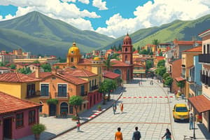
Costa Region
- Location: The Costa Region extends from the Mataje river to the north, to the Tumbes River to the south, and from the western Andes to the Pacific Ocean.
- Relief: The region is a large plain and a mountain range that originates two zones: the interior coast and the exterior coast.
- The Interior Coast: Rich in rivers, it is the space between the coastal mountain range and the western branch of the Andes Mountains.
- The Exterior Coast: It is the space between the coastal mountain range and the coast.
- Hydrography: The Costa Region has four hydrographic systems:
- Santiago River: Navigable to Esmeraldas, with the Cayapas River as its tributary.
- Esmeraldas River: Empties into the port of Esmeraldas, with the Blanco, Toachi, and Quinindé Rivers as its tributaries.
- Guayas River: Its basin is formed by the Babahoyo, Daule, Vinces, and Zapotal Rivers.
- Jubones River: Originates in the province of El Oro and empties into the Gulf of Guayaquil, with the Casacay, Huizho, Muyuyacu, Quera, Cuné, and Galayacu rivers as its tributaries.
Studying That Suits You
Use AI to generate personalized quizzes and flashcards to suit your learning preferences.