Podcast
Questions and Answers
Which layer of the Earth is best described as being composed of tectonic plates?
Which layer of the Earth is best described as being composed of tectonic plates?
- Outer Core
- Mantle
- Inner Core
- Crust (correct)
The Mohorovičić discontinuity (Moho) marks the boundary between which two layers of the Earth?
The Mohorovičić discontinuity (Moho) marks the boundary between which two layers of the Earth?
- Crust and Mantle (correct)
- Outer core and Inner core
- Lithosphere and Asthenosphere
- Mantle and Outer core
Which of the following processes leads to the formation of sedimentary rocks?
Which of the following processes leads to the formation of sedimentary rocks?
- Compaction and cementation of sediments (correct)
- Crystallization from a molten state
- Transformation of existing rocks under heat and pressure
- Cooling and solidification of magma
Which type of intrusive igneous body is characterized as a large, deep-seated mass of solidified magma?
Which type of intrusive igneous body is characterized as a large, deep-seated mass of solidified magma?
Karst landscapes, known for caves and springs, are most commonly associated with which type of rock?
Karst landscapes, known for caves and springs, are most commonly associated with which type of rock?
Alfred Wegener's theory of continental drift was initially supported by the 'jigsaw fit' evidence observed between which two continents?
Alfred Wegener's theory of continental drift was initially supported by the 'jigsaw fit' evidence observed between which two continents?
Which geological feature is typically formed at a constructive plate margin?
Which geological feature is typically formed at a constructive plate margin?
The San Andreas Fault in California is an example of which type of plate margin?
The San Andreas Fault in California is an example of which type of plate margin?
Which type of plate margin is primarily responsible for the formation of major mountain ranges like the Himalayas?
Which type of plate margin is primarily responsible for the formation of major mountain ranges like the Himalayas?
What type of geological structure is formed when rock layers bend under compressional forces?
What type of geological structure is formed when rock layers bend under compressional forces?
In structural geology, what is a syncline?
In structural geology, what is a syncline?
Horsts and grabens are landforms primarily associated with what geological process?
Horsts and grabens are landforms primarily associated with what geological process?
The East African Rift Valley is an example of which type of fault-related landform?
The East African Rift Valley is an example of which type of fault-related landform?
What instrument is used to detect and record seismic waves during an earthquake?
What instrument is used to detect and record seismic waves during an earthquake?
Which type of seismic wave is known as the fastest and can travel through both solids and liquids?
Which type of seismic wave is known as the fastest and can travel through both solids and liquids?
What is the term for the point on the Earth's surface directly above the origin of an earthquake?
What is the term for the point on the Earth's surface directly above the origin of an earthquake?
On the Richter scale, an earthquake of magnitude 7.5 is classified as:
On the Richter scale, an earthquake of magnitude 7.5 is classified as:
Which of the following is a primary cause of tsunamis?
Which of the following is a primary cause of tsunamis?
Which of the following is NOT typically monitored to predict volcanic eruptions?
Which of the following is NOT typically monitored to predict volcanic eruptions?
What type of volcano is characterized by broad, gently sloping sides formed from fluid lava flows?
What type of volcano is characterized by broad, gently sloping sides formed from fluid lava flows?
Mount Fujiyama in Japan is classified as which type of volcano based on its eruptive history?
Mount Fujiyama in Japan is classified as which type of volcano based on its eruptive history?
Volcanic soils are known to be particularly fertile due to their richness in:
Volcanic soils are known to be particularly fertile due to their richness in:
Which of the following best describes the asthenosphere's physical state?
Which of the following best describes the asthenosphere's physical state?
The presence of similar Lystrosaurus fossils across continents separated by oceans is considered evidence for:
The presence of similar Lystrosaurus fossils across continents separated by oceans is considered evidence for:
Which of the following is a characteristic feature of a destructive plate margin?
Which of the following is a characteristic feature of a destructive plate margin?
In an overthrust fold (nappe), what is the most significant characteristic?
In an overthrust fold (nappe), what is the most significant characteristic?
Which type of fault is primarily caused by tensional forces pulling rocks apart?
Which type of fault is primarily caused by tensional forces pulling rocks apart?
Which seismic wave type typically causes the most damage during an earthquake?
Which seismic wave type typically causes the most damage during an earthquake?
Why do developing countries often experience greater devastation from earthquakes compared to developed countries?
Why do developing countries often experience greater devastation from earthquakes compared to developed countries?
Which of the following is a direct positive impact of volcanic activity on human society?
Which of the following is a direct positive impact of volcanic activity on human society?
Consider a scenario where a geologist finds a vertical, sheet-like igneous intrusion that cuts across existing horizontal sedimentary rock layers. This feature is most likely a:
Consider a scenario where a geologist finds a vertical, sheet-like igneous intrusion that cuts across existing horizontal sedimentary rock layers. This feature is most likely a:
If scientists detect an increase in sulfur dioxide emissions and ground deformation around a known dormant volcano, what is the most likely interpretation?
If scientists detect an increase in sulfur dioxide emissions and ground deformation around a known dormant volcano, what is the most likely interpretation?
Which of the following statements accurately contrasts P-waves and S-waves?
Which of the following statements accurately contrasts P-waves and S-waves?
Consider two locations: one on a shield volcano and another on a composite volcano. Which of the following statements correctly compares potential volcanic hazards?
Consider two locations: one on a shield volcano and another on a composite volcano. Which of the following statements correctly compares potential volcanic hazards?
Imagine a scenario where a coastal community is located near a subduction zone. Which of the following preparedness measures would be MOST crucial to implement to mitigate earthquake and tsunami risks?
Imagine a scenario where a coastal community is located near a subduction zone. Which of the following preparedness measures would be MOST crucial to implement to mitigate earthquake and tsunami risks?
Which of the following statements is LEAST accurate regarding the rock cycle?
Which of the following statements is LEAST accurate regarding the rock cycle?
A region is characterized by anticlines and synclines, terraced slopes used for agriculture, and rivers harnessed for hydroelectric power. This landscape is MOST likely associated with:
A region is characterized by anticlines and synclines, terraced slopes used for agriculture, and rivers harnessed for hydroelectric power. This landscape is MOST likely associated with:
Imagine two tectonic plates are moving towards each other. Plate A is denser oceanic crust, and Plate B is lighter continental crust. What geological event is MOST likely to occur at their convergent boundary?
Imagine two tectonic plates are moving towards each other. Plate A is denser oceanic crust, and Plate B is lighter continental crust. What geological event is MOST likely to occur at their convergent boundary?
Consider a hypothetical planet with active plate tectonics but no liquid outer core. Which of the following would be the MOST likely consequence regarding the planet's geological activity?
Consider a hypothetical planet with active plate tectonics but no liquid outer core. Which of the following would be the MOST likely consequence regarding the planet's geological activity?
A scientist is studying a newly discovered volcanic island arc. Based on the geological setting, which type of plate boundary is MOST likely responsible for its formation?
A scientist is studying a newly discovered volcanic island arc. Based on the geological setting, which type of plate boundary is MOST likely responsible for its formation?
Imagine you are analyzing seismic data from an earthquake. You observe that S-waves are not detected beyond a certain depth within the Earth. What does this observation primarily indicate about the Earth's interior?
Imagine you are analyzing seismic data from an earthquake. You observe that S-waves are not detected beyond a certain depth within the Earth. What does this observation primarily indicate about the Earth's interior?
Which tectonic plate margin is associated with the creation of new crustal material?
Which tectonic plate margin is associated with the creation of new crustal material?
According to the rock cycle, what process leads to the formation of sedimentary rocks?
According to the rock cycle, what process leads to the formation of sedimentary rocks?
Which type of intrusive igneous body is characterized by a vertical, sheet-like formation that cuts across existing rock layers?
Which type of intrusive igneous body is characterized by a vertical, sheet-like formation that cuts across existing rock layers?
What geological evidence supports Alfred Wegener's theory of continental drift?
What geological evidence supports Alfred Wegener's theory of continental drift?
What type of geological structure results from the bending of rock layers under compressional forces?
What type of geological structure results from the bending of rock layers under compressional forces?
Which seismic wave type cannot travel through the Earth's liquid outer core?
Which seismic wave type cannot travel through the Earth's liquid outer core?
What observable change would best suggest that a dormant volcano is becoming active?
What observable change would best suggest that a dormant volcano is becoming active?
Which of the following scenarios would likely result in the most significant and widespread damage from an earthquake?
Which of the following scenarios would likely result in the most significant and widespread damage from an earthquake?
Following a major volcanic eruption, what long-term benefit is most likely to arise in the surrounding area?
Following a major volcanic eruption, what long-term benefit is most likely to arise in the surrounding area?
A geologist discovers a new type of metamorphic rock with aligned, needle-like crystals. This rock was MOST likely subjected to:
A geologist discovers a new type of metamorphic rock with aligned, needle-like crystals. This rock was MOST likely subjected to:
Which layer of the Earth is in a liquid state?
Which layer of the Earth is in a liquid state?
What primarily drives the movement of tectonic plates?
What primarily drives the movement of tectonic plates?
Which process describes the creation of new rock from existing rock material?
Which process describes the creation of new rock from existing rock material?
What type of rock is formed from the cooling and solidification of magma or lava?
What type of rock is formed from the cooling and solidification of magma or lava?
Which evidence did Alfred Wegener use to support his theory of continental drift?
Which evidence did Alfred Wegener use to support his theory of continental drift?
What type of plate boundary is associated with the formation of mid-ocean ridges?
What type of plate boundary is associated with the formation of mid-ocean ridges?
Which process is primarily responsible for the creation of fold mountains?
Which process is primarily responsible for the creation of fold mountains?
Which statement accurately describes the lithosphere?
Which statement accurately describes the lithosphere?
What is a key characteristic of sedimentary rocks that aids in their identification?
What is a key characteristic of sedimentary rocks that aids in their identification?
How do dykes and sills differ in their formation within existing rock structures?
How do dykes and sills differ in their formation within existing rock structures?
What role do convection currents play in the context of plate tectonics?
What role do convection currents play in the context of plate tectonics?
Which type of plate boundary typically results in the formation of a volcanic island arc?
Which type of plate boundary typically results in the formation of a volcanic island arc?
How does an overthrust fold (nappe) typically form?
How does an overthrust fold (nappe) typically form?
At which type of plate boundary are reverse faults most commonly observed?
At which type of plate boundary are reverse faults most commonly observed?
How might changes in animal behavior potentially be used in earthquake prediction?
How might changes in animal behavior potentially be used in earthquake prediction?
How do developing countries generally differ from developed countries in terms of earthquake impact?
How do developing countries generally differ from developed countries in terms of earthquake impact?
What is the primary reason volcanic soils are known for their fertility?
What is the primary reason volcanic soils are known for their fertility?
Which combination of factors contributes to the formation of metamorphic rocks?
Which combination of factors contributes to the formation of metamorphic rocks?
How does the rate of cooling affect the crystal size in igneous rocks?
How does the rate of cooling affect the crystal size in igneous rocks?
Which geological evidence provides the strongest support for the past existence of Pangaea?
Which geological evidence provides the strongest support for the past existence of Pangaea?
What geological feature results from tensional forces pulling rocks apart?
What geological feature results from tensional forces pulling rocks apart?
Which type of seismic wave cannot travel through the Earth's liquid outer core, providing critical evidence about its structure?
Which type of seismic wave cannot travel through the Earth's liquid outer core, providing critical evidence about its structure?
How does monitoring ground deformation with tilt meters aid in predicting volcanic eruptions?
How does monitoring ground deformation with tilt meters aid in predicting volcanic eruptions?
What conditions are necessary for the formation of an overthrust fold (nappe)?
What conditions are necessary for the formation of an overthrust fold (nappe)?
Which of the following best explains why certain animal behaviors might be precursors to earthquakes?
Which of the following best explains why certain animal behaviors might be precursors to earthquakes?
How does the internal structure of composite volcanoes contribute to their explosive eruptions?
How does the internal structure of composite volcanoes contribute to their explosive eruptions?
Which aspect of plate tectonics is most directly responsible for the formation of deep-sea trenches?
Which aspect of plate tectonics is most directly responsible for the formation of deep-sea trenches?
In what way does improved infrastructure contribute to mitigating earthquake damage in developed countries?
In what way does improved infrastructure contribute to mitigating earthquake damage in developed countries?
How do seismologists use the difference in arrival times between P-waves and S-waves to locate an earthquake's epicenter?
How do seismologists use the difference in arrival times between P-waves and S-waves to locate an earthquake's epicenter?
What characteristics of shield volcanoes make them less prone to violent eruptions compared to composite volcanoes?
What characteristics of shield volcanoes make them less prone to violent eruptions compared to composite volcanoes?
Why studying the distribution of certain non-swimming reptile fossils on multiple continents important in understanding plate tectonics?
Why studying the distribution of certain non-swimming reptile fossils on multiple continents important in understanding plate tectonics?
Imagine a coastal region with a history of strong earthquakes and tsunamis. What strategy would LEAST likely be effective in reducing community vulnerability?
Imagine a coastal region with a history of strong earthquakes and tsunamis. What strategy would LEAST likely be effective in reducing community vulnerability?
Consider a hypothetical planet with active volcanism but no plate tectonics. How would the distribution of volcanoes likely differ from that on Earth?
Consider a hypothetical planet with active volcanism but no plate tectonics. How would the distribution of volcanoes likely differ from that on Earth?
How might seismic waves reveal the presence of a partially molten zone deep within the Earth's mantle, without direct observation?
How might seismic waves reveal the presence of a partially molten zone deep within the Earth's mantle, without direct observation?
Which statement would best describe the tectonic interaction along the East African Rift Valley?
Which statement would best describe the tectonic interaction along the East African Rift Valley?
Imagine a scenario where a highly advanced civilization wants to create new land by accelerating plate tectonic processes. Which approach would face the greatest geological challenges?
Imagine a scenario where a highly advanced civilization wants to create new land by accelerating plate tectonic processes. Which approach would face the greatest geological challenges?
A planet has only one large continent and a single global ocean. If plate tectonic activity begins, how would the initial stages MOST likely manifest?
A planet has only one large continent and a single global ocean. If plate tectonic activity begins, how would the initial stages MOST likely manifest?
Which layer of the Earth is primarily composed of nickel and iron in a liquid state?
Which layer of the Earth is primarily composed of nickel and iron in a liquid state?
What is the primary factor that determines the crystal size in an intrusive igneous rock?
What is the primary factor that determines the crystal size in an intrusive igneous rock?
Which type of intrusive igneous body is characterized by its vertical, dike-like shape that cuts discordantly across existing rock layers?
Which type of intrusive igneous body is characterized by its vertical, dike-like shape that cuts discordantly across existing rock layers?
What evidence supporting the theory of continental drift is demonstrated by the close alignment between the east coast of South America and the west coast of Africa?
What evidence supporting the theory of continental drift is demonstrated by the close alignment between the east coast of South America and the west coast of Africa?
At which type of plate margin do tectonic plates slide past each other horizontally, neither creating nor destroying lithosphere?
At which type of plate margin do tectonic plates slide past each other horizontally, neither creating nor destroying lithosphere?
What type of fold occurs due to extreme pressure, causing the rock to fracture and slide over itself, often resulting in extensive displacement?
What type of fold occurs due to extreme pressure, causing the rock to fracture and slide over itself, often resulting in extensive displacement?
Which type of fault is primarily the result of tensional forces pulling rocks apart, leading to the downward displacement of a block of rock relative to the blocks on either side?
Which type of fault is primarily the result of tensional forces pulling rocks apart, leading to the downward displacement of a block of rock relative to the blocks on either side?
When an earthquake occurs, which seismic wave type typically causes the most significant damage to surface structures?
When an earthquake occurs, which seismic wave type typically causes the most significant damage to surface structures?
Consider two volcanoes: Volcano A, a shield volcano with low-viscosity lava, and Volcano B, a composite volcano with high-viscosity lava and significant pyroclastic material. All other factors being equal, which of the following statements is MOST accurate regarding their eruption styles?
Consider two volcanoes: Volcano A, a shield volcano with low-viscosity lava, and Volcano B, a composite volcano with high-viscosity lava and significant pyroclastic material. All other factors being equal, which of the following statements is MOST accurate regarding their eruption styles?
Imagine a scenario in which a series of moderate earthquakes strike a coastal region over a year. After each quake, local authorities reinforce buildings along the coast. Over time, the seismicity increases but so does government investment in retrofitting infrastructures that now include a tsunami warning system. Considering ONLY the concepts presented, what could offset such benefits?
Imagine a scenario in which a series of moderate earthquakes strike a coastal region over a year. After each quake, local authorities reinforce buildings along the coast. Over time, the seismicity increases but so does government investment in retrofitting infrastructures that now include a tsunami warning system. Considering ONLY the concepts presented, what could offset such benefits?
Which layer of the Earth is primarily composed of solid iron and nickel?
Which layer of the Earth is primarily composed of solid iron and nickel?
What drives the movement of tectonic plates?
What drives the movement of tectonic plates?
What is the correct order of layers from the surface to the center of the Earth?
What is the correct order of layers from the surface to the center of the Earth?
Which of the following landforms is typically associated with sedimentary rock?
Which of the following landforms is typically associated with sedimentary rock?
What type of plate margin is the San Andreas Fault in California an example of?
What type of plate margin is the San Andreas Fault in California an example of?
Which geological process leads to the formation of metamorphic rocks?
Which geological process leads to the formation of metamorphic rocks?
What is the name of the supercontinent that Alfred Wegener proposed existed millions of years ago?
What is the name of the supercontinent that Alfred Wegener proposed existed millions of years ago?
What is the primary cause of earthquakes?
What is the primary cause of earthquakes?
Which of the following factors influences landscape formation?
Which of the following factors influences landscape formation?
Which geological feature is commonly formed at a constructive plate margin?
Which geological feature is commonly formed at a constructive plate margin?
Which of the following intrusive igneous bodies is characterized as a large, deep-seated mass of solidified magma?
Which of the following intrusive igneous bodies is characterized as a large, deep-seated mass of solidified magma?
Which type of seismic wave cannot travel through liquid?
Which type of seismic wave cannot travel through liquid?
What is the primary difference between a sill and a dyke?
What is the primary difference between a sill and a dyke?
What is the main difference between a syncline and an anticline?
What is the main difference between a syncline and an anticline?
According to the theory of plate tectonics, where do most earthquakes and volcanoes occur?
According to the theory of plate tectonics, where do most earthquakes and volcanoes occur?
Which type of plate boundary is most commonly associated with the formation of major mountain ranges like the Himalayas?
Which type of plate boundary is most commonly associated with the formation of major mountain ranges like the Himalayas?
What evidence supported Alfred Wegener's theory of continental drift?
What evidence supported Alfred Wegener's theory of continental drift?
Which of the listed effects of earthquakes causes the most damage to infrastructure within developed nations?
Which of the listed effects of earthquakes causes the most damage to infrastructure within developed nations?
Which of the following describes how the intensity on the Richter scale is expressed?
Which of the following describes how the intensity on the Richter scale is expressed?
What is an overthrust fold (nappe)?
What is an overthrust fold (nappe)?
Which of the following would be the MOST effective method of distinguishing an active volcano from a dormant volcano?
Which of the following would be the MOST effective method of distinguishing an active volcano from a dormant volcano?
How do scientists monitor volcanoes to predict potential eruptions?
How do scientists monitor volcanoes to predict potential eruptions?
What are the best locations for agriculture upon mountains formed via tectonic folds?
What are the best locations for agriculture upon mountains formed via tectonic folds?
Which of the following statements correctly contrasts P-waves and S-waves in terms of their behavior and properties?
Which of the following statements correctly contrasts P-waves and S-waves in terms of their behavior and properties?
Which of these options would offer the best protection against an earthquake in a developing country?
Which of these options would offer the best protection against an earthquake in a developing country?
During the formation of sedimentary rocks, what process transforms accumulated sediments into solid rock?
During the formation of sedimentary rocks, what process transforms accumulated sediments into solid rock?
What is the primary mechanism behind the formation of rift valleys?
What is the primary mechanism behind the formation of rift valleys?
Which of the following contributes to the fertile conditions of volcanic soils?
Which of the following contributes to the fertile conditions of volcanic soils?
Which of the following is LEAST accurate regarding the rock cycle?
Which of the following is LEAST accurate regarding the rock cycle?
Consider two tectonic plates: Plate A, primarily composed of basalt, and Plate B, mainly of granite. Which statement would need further evidence to support it:?
Consider two tectonic plates: Plate A, primarily composed of basalt, and Plate B, mainly of granite. Which statement would need further evidence to support it:?
Consider a coastal town situated near both an active subduction zone and a major river delta. What are the most pertinent threats?
Consider a coastal town situated near both an active subduction zone and a major river delta. What are the most pertinent threats?
According to the theory of plate tectonics, what geological feature is most closely associated with the phenomenon of subduction?
According to the theory of plate tectonics, what geological feature is most closely associated with the phenomenon of subduction?
Which of the following natural events can commonly trigger a tsunami?
Which of the following natural events can commonly trigger a tsunami?
What type of volcano is characterized by gentle slopes formed by the eruption of low-viscosity lava?
What type of volcano is characterized by gentle slopes formed by the eruption of low-viscosity lava?
In the context of plate tectonics, what is a 'hotspot'?
In the context of plate tectonics, what is a 'hotspot'?
If a region is experiencing frequent, moderate earthquakes, and geologists observe a consistent uplift of the land surface along with changes in groundwater chemistry, which of the following inferences is most likely?
If a region is experiencing frequent, moderate earthquakes, and geologists observe a consistent uplift of the land surface along with changes in groundwater chemistry, which of the following inferences is most likely?
Consider a hypothetical scenario: Scientists discover a new planet with active volcanism. This planet lacks tectonic plates but does exhibit tidal forces due to a large, nearby moon. How does this differ from earth?
Consider a hypothetical scenario: Scientists discover a new planet with active volcanism. This planet lacks tectonic plates but does exhibit tidal forces due to a large, nearby moon. How does this differ from earth?
Which of the following best describes the composition of Earth's outer core?
Which of the following best describes the composition of Earth's outer core?
According to the rock cycle, what is the direct result of magma cooling and solidifying?
According to the rock cycle, what is the direct result of magma cooling and solidifying?
According to Wegener's theory of continental drift, which evidence did Lystrosaurus fossils provide?
According to Wegener's theory of continental drift, which evidence did Lystrosaurus fossils provide?
Which type of plate boundary is primarily responsible for the formation of the Himalayas?
Which type of plate boundary is primarily responsible for the formation of the Himalayas?
What type of geological structure results from compressional forces causing rock layers to bend upwards?
What type of geological structure results from compressional forces causing rock layers to bend upwards?
Which seismic wave type cannot travel through the Earth's liquid outer core, providing critical evidence about its structure?
Which seismic wave type cannot travel through the Earth's liquid outer core, providing critical evidence about its structure?
In what way does monitoring ground deformation with tilt meters aid in predicting volcanic eruptions?
In what way does monitoring ground deformation with tilt meters aid in predicting volcanic eruptions?
Consider a hypothetical planet with active plate tectonics, an atmosphere with the same pressure as Earth, and a similar distribution of landmasses. Given these conditions, if the planet's mantle convection was significantly less vigorous than Earth's, how would the volcanism and average crustal age MOST likely differ?
Consider a hypothetical planet with active plate tectonics, an atmosphere with the same pressure as Earth, and a similar distribution of landmasses. Given these conditions, if the planet's mantle convection was significantly less vigorous than Earth's, how would the volcanism and average crustal age MOST likely differ?
Critically evaluate the proposition that the Mohorovičić discontinuity represents a chemically homogenous boundary, considering the phase transitions and compositional gradients within the Earth's interior.
Critically evaluate the proposition that the Mohorovičić discontinuity represents a chemically homogenous boundary, considering the phase transitions and compositional gradients within the Earth's interior.
Assess the validity of the claim that the Earth's outer core's liquidity is solely attributable to elevated temperatures, disregarding other pertinent physicochemical parameters.
Assess the validity of the claim that the Earth's outer core's liquidity is solely attributable to elevated temperatures, disregarding other pertinent physicochemical parameters.
Evaluate the assertion that crystal size in igneous rocks is exclusively a function of cooling rate, neglecting other influential variables in magma crystallization kinetics.
Evaluate the assertion that crystal size in igneous rocks is exclusively a function of cooling rate, neglecting other influential variables in magma crystallization kinetics.
Critically analyze the proposition that sedimentary rock formation is solely a diagenetic process, thereby excluding the initial stages of weathering and erosion.
Critically analyze the proposition that sedimentary rock formation is solely a diagenetic process, thereby excluding the initial stages of weathering and erosion.
Evaluate the claim that batholiths, being deep-seated intrusive bodies, exert negligible influence on surficial landscape evolution compared to extrusive volcanic features.
Evaluate the claim that batholiths, being deep-seated intrusive bodies, exert negligible influence on surficial landscape evolution compared to extrusive volcanic features.
Assess the relative contributions of sedimentary and igneous rock types to the formation of karst landscapes, considering their respective solubility and structural properties.
Assess the relative contributions of sedimentary and igneous rock types to the formation of karst landscapes, considering their respective solubility and structural properties.
Critically evaluate Wegener's 'jigsaw fit' of continents as unequivocal evidence for continental drift, considering subsequent geophysical and geological findings.
Critically evaluate Wegener's 'jigsaw fit' of continents as unequivocal evidence for continental drift, considering subsequent geophysical and geological findings.
Assess the relative geological significance of constructive versus conservative plate margins in terms of crustal evolution and global tectonic dynamics.
Assess the relative geological significance of constructive versus conservative plate margins in terms of crustal evolution and global tectonic dynamics.
Evaluate the assertion that collision plate margins, exemplified by the Himalayas, are devoid of volcanic activity, contrasting them with destructive margins.
Evaluate the assertion that collision plate margins, exemplified by the Himalayas, are devoid of volcanic activity, contrasting them with destructive margins.
Critically compare and contrast the seismogenic potential of conservative (transform) plate margins with that of destructive (convergent) plate margins, considering the mechanisms of stress accumulation and release.
Critically compare and contrast the seismogenic potential of conservative (transform) plate margins with that of destructive (convergent) plate margins, considering the mechanisms of stress accumulation and release.
Evaluate the efficacy of relying solely on precursory animal behavior as a reliable method for earthquake prediction in modern seismological practice.
Evaluate the efficacy of relying solely on precursory animal behavior as a reliable method for earthquake prediction in modern seismological practice.
Assess the comparative effectiveness of P-wave versus S-wave arrival times for precise earthquake epicenter location, considering their propagation characteristics and instrumental detection.
Assess the comparative effectiveness of P-wave versus S-wave arrival times for precise earthquake epicenter location, considering their propagation characteristics and instrumental detection.
Critically evaluate the proposition that the Richter scale directly measures the intensity of an earthquake's impact on human structures and populations.
Critically evaluate the proposition that the Richter scale directly measures the intensity of an earthquake's impact on human structures and populations.
Assess the relative destructive potential of P-waves, S-waves, and surface waves during a major earthquake, considering their distinct propagation characteristics and ground motion effects.
Assess the relative destructive potential of P-waves, S-waves, and surface waves during a major earthquake, considering their distinct propagation characteristics and ground motion effects.
Evaluate the proposition that tsunami generation is exclusively linked to vertical displacement of the seafloor during submarine earthquakes, disregarding other potential causative mechanisms.
Evaluate the proposition that tsunami generation is exclusively linked to vertical displacement of the seafloor during submarine earthquakes, disregarding other potential causative mechanisms.
Critically compare shield volcanoes and composite volcanoes (stratovolcanoes) in terms of their eruptive styles, magma viscosities, and resulting geomorphological forms.
Critically compare shield volcanoes and composite volcanoes (stratovolcanoes) in terms of their eruptive styles, magma viscosities, and resulting geomorphological forms.
Evaluate the role of volatile content in differentiating the eruption styles of shield volcanoes versus composite volcanoes, considering magma genesis and ascent dynamics.
Evaluate the role of volatile content in differentiating the eruption styles of shield volcanoes versus composite volcanoes, considering magma genesis and ascent dynamics.
Assess the long-term impact of volcanic eruptions on soil fertility, contrasting the immediate destructive effects with subsequent pedogenic processes.
Assess the long-term impact of volcanic eruptions on soil fertility, contrasting the immediate destructive effects with subsequent pedogenic processes.
Critically evaluate the classification of volcanoes into active, dormant, and extinct categories based solely on recorded historical eruptions, considering geological timescales and eruption recurrence intervals.
Critically evaluate the classification of volcanoes into active, dormant, and extinct categories based solely on recorded historical eruptions, considering geological timescales and eruption recurrence intervals.
Assess the relative roles of pressure, temperature, and water content in magma generation at different tectonic settings, specifically at mid-ocean ridges, subduction zones, and mantle plumes.
Assess the relative roles of pressure, temperature, and water content in magma generation at different tectonic settings, specifically at mid-ocean ridges, subduction zones, and mantle plumes.
Critically compare the formation mechanisms of dykes and sills, emphasizing their orientations relative to pre-existing rock structures and the stress regimes under which they typically form.
Critically compare the formation mechanisms of dykes and sills, emphasizing their orientations relative to pre-existing rock structures and the stress regimes under which they typically form.
Evaluate the statement that fold mountains are exclusively formed at collision plate margins, neglecting other potential orogenic mechanisms contributing to mountain building.
Evaluate the statement that fold mountains are exclusively formed at collision plate margins, neglecting other potential orogenic mechanisms contributing to mountain building.
Assess the relative contributions of folding and faulting processes to the formation of major mountain ranges, considering the dominant tectonic forces and rock rheologies involved.
Assess the relative contributions of folding and faulting processes to the formation of major mountain ranges, considering the dominant tectonic forces and rock rheologies involved.
Critically compare the geological characteristics and landscape expressions of horsts and grabens, emphasizing their relationship to extensional tectonic regimes and normal faulting.
Critically compare the geological characteristics and landscape expressions of horsts and grabens, emphasizing their relationship to extensional tectonic regimes and normal faulting.
Evaluate the role of isostatic rebound in the long-term landscape evolution of regions previously covered by continental ice sheets, considering glacial loading and unloading processes.
Evaluate the role of isostatic rebound in the long-term landscape evolution of regions previously covered by continental ice sheets, considering glacial loading and unloading processes.
Assess the comparative agricultural potential of landscapes formed on sedimentary versus igneous rock terrains, considering soil fertility, drainage characteristics, and topographic influences.
Assess the comparative agricultural potential of landscapes formed on sedimentary versus igneous rock terrains, considering soil fertility, drainage characteristics, and topographic influences.
Evaluate the role of plate tectonics in controlling global climate patterns over geological timescales, considering the influence of continental drift, ocean basin configuration, and volcanic outgassing.
Evaluate the role of plate tectonics in controlling global climate patterns over geological timescales, considering the influence of continental drift, ocean basin configuration, and volcanic outgassing.
Assess the relative vulnerability of developed versus developing countries to earthquake disasters, beyond infrastructure resilience, considering socio-economic factors, governance, and disaster preparedness culture.
Assess the relative vulnerability of developed versus developing countries to earthquake disasters, beyond infrastructure resilience, considering socio-economic factors, governance, and disaster preparedness culture.
Evaluate the efficacy of tsunami early warning systems (TEWS) in mitigating coastal hazards, considering factors like warning dissemination speed, community response capacity, and the near-field tsunami challenge.
Evaluate the efficacy of tsunami early warning systems (TEWS) in mitigating coastal hazards, considering factors like warning dissemination speed, community response capacity, and the near-field tsunami challenge.
Assess the role of mantle convection in driving plate tectonics, contrasting active versus passive mantle upwelling models and their implications for plate motion and surface geology.
Assess the role of mantle convection in driving plate tectonics, contrasting active versus passive mantle upwelling models and their implications for plate motion and surface geology.
Critically evaluate the rock cycle as a strictly linear and unidirectional process, considering the complexities of geological recycling and crustal evolution.
Critically evaluate the rock cycle as a strictly linear and unidirectional process, considering the complexities of geological recycling and crustal evolution.
Assess the validity of using fossil distribution patterns, such as Lystrosaurus, as unequivocal proof of past continental connections, considering alternative biogeographic dispersal mechanisms.
Assess the validity of using fossil distribution patterns, such as Lystrosaurus, as unequivocal proof of past continental connections, considering alternative biogeographic dispersal mechanisms.
Evaluate the statement that all volcanic soils are inherently fertile, neglecting variations in volcanic material composition, weathering rates, and climatic conditions.
Evaluate the statement that all volcanic soils are inherently fertile, neglecting variations in volcanic material composition, weathering rates, and climatic conditions.
Assess the predictability of volcanic eruptions compared to earthquakes, considering the nature of precursory signals, monitoring techniques, and the underlying physical processes.
Assess the predictability of volcanic eruptions compared to earthquakes, considering the nature of precursory signals, monitoring techniques, and the underlying physical processes.
Critically compare the asthenosphere and lithosphere in terms of their rheological properties, depths within the Earth, and roles in plate tectonic processes.
Critically compare the asthenosphere and lithosphere in terms of their rheological properties, depths within the Earth, and roles in plate tectonic processes.
Consider a hypothetical scenario where the Earth's outer core were to completely solidify. Which of the following consequential geophysical changes would MOST likely occur, considering magnetohydrodynamic principles?
Consider a hypothetical scenario where the Earth's outer core were to completely solidify. Which of the following consequential geophysical changes would MOST likely occur, considering magnetohydrodynamic principles?
Assuming a planet with similar size and composition to Earth, but with significantly reduced radioactive element concentration in its mantle, what long-term effect would MOST profoundly influence its plate tectonic regime?
Assuming a planet with similar size and composition to Earth, but with significantly reduced radioactive element concentration in its mantle, what long-term effect would MOST profoundly influence its plate tectonic regime?
If advanced seismic tomography revealed a substantial increase in the shear-wave velocity within the Earth's D'' layer (the lowermost mantle), which of the following interpretations would be MOST consistent with current geodynamic models?
If advanced seismic tomography revealed a substantial increase in the shear-wave velocity within the Earth's D'' layer (the lowermost mantle), which of the following interpretations would be MOST consistent with current geodynamic models?
Considering the principle of isostasy and the viscoelastic properties of the asthenosphere, how would the complete removal of a major continental ice sheet (e.g., Greenland) MOST likely affect regional seismicity and fault behavior in the underlying lithosphere over geological timescales?
Considering the principle of isostasy and the viscoelastic properties of the asthenosphere, how would the complete removal of a major continental ice sheet (e.g., Greenland) MOST likely affect regional seismicity and fault behavior in the underlying lithosphere over geological timescales?
In the context of metamorphic petrology, which combination of parameters would MOST effectively promote the formation of eclogite facies rocks within a subduction zone environment?
In the context of metamorphic petrology, which combination of parameters would MOST effectively promote the formation of eclogite facies rocks within a subduction zone environment?
Given a region undergoing progressive simple shear deformation, how would the orientation of foliation planes in metamorphic rocks MOST likely evolve relative to the principal stress axes, assuming strain hardening and rotation of rigid inclusions?
Given a region undergoing progressive simple shear deformation, how would the orientation of foliation planes in metamorphic rocks MOST likely evolve relative to the principal stress axes, assuming strain hardening and rotation of rigid inclusions?
Consider a scenario where seismic data reveal a pronounced low-velocity zone (LVZ) at the base of the lithosphere beneath a mid-ocean ridge. Which process would be the MOST plausible explanation for the origin and maintenance of this LVZ?
Consider a scenario where seismic data reveal a pronounced low-velocity zone (LVZ) at the base of the lithosphere beneath a mid-ocean ridge. Which process would be the MOST plausible explanation for the origin and maintenance of this LVZ?
If a newly discovered extraterrestrial planet exhibits plate tectonics but lacks a liquid outer core, how would its volcanic activity MOST likely differ from that of Earth, considering the absence of a global magnetic field?
If a newly discovered extraterrestrial planet exhibits plate tectonics but lacks a liquid outer core, how would its volcanic activity MOST likely differ from that of Earth, considering the absence of a global magnetic field?
Considering the influence of volatile content on magma viscosity, which scenario would MOST likely promote the generation of highly explosive eruptions at a subduction zone volcano?
Considering the influence of volatile content on magma viscosity, which scenario would MOST likely promote the generation of highly explosive eruptions at a subduction zone volcano?
Assuming a significant increase in global erosion rates due to anthropogenic climate change, how would the long-term isostatic response of continental crust MOST likely affect the frequency and magnitude of shallow crustal earthquakes in tectonically stable regions?
Assuming a significant increase in global erosion rates due to anthropogenic climate change, how would the long-term isostatic response of continental crust MOST likely affect the frequency and magnitude of shallow crustal earthquakes in tectonically stable regions?
Flashcards
Crust
Crust
The Earth's outermost solid layer, thinner under oceans and thicker under continents. It's divided into tectonic plates.
Mantle
Mantle
Located beneath the crust, it's a thick layer of solid but plastic-like rock capable of flow, with temperatures up to 5,000°C.
Outer Core
Outer Core
A liquid layer beneath the mantle, composed mainly of nickel and iron, with a thickness of about 2,250 km.
Inner Core
Inner Core
Signup and view all the flashcards
Formation of Igneous Rock
Formation of Igneous Rock
Signup and view all the flashcards
Formation of Sedimentary Rock
Formation of Sedimentary Rock
Signup and view all the flashcards
Formation of Metamorphic Rock
Formation of Metamorphic Rock
Signup and view all the flashcards
Batholiths
Batholiths
Signup and view all the flashcards
Laccoliths and Lopoliths
Laccoliths and Lopoliths
Signup and view all the flashcards
Dykes and Sills
Dykes and Sills
Signup and view all the flashcards
Pipes
Pipes
Signup and view all the flashcards
Karst Landscapes
Karst Landscapes
Signup and view all the flashcards
Tors
Tors
Signup and view all the flashcards
Pangaea
Pangaea
Signup and view all the flashcards
Jigsaw Fit
Jigsaw Fit
Signup and view all the flashcards
Geology and Fossils
Geology and Fossils
Signup and view all the flashcards
Glacial Deposits
Glacial Deposits
Signup and view all the flashcards
Coal Deposits
Coal Deposits
Signup and view all the flashcards
Distribution of Fossils
Distribution of Fossils
Signup and view all the flashcards
Plate Tectonics
Plate Tectonics
Signup and view all the flashcards
Constructive Margins (Divergent)
Constructive Margins (Divergent)
Signup and view all the flashcards
Destructive Margins (Convergent)
Destructive Margins (Convergent)
Signup and view all the flashcards
Conservative Margins (Transform)
Conservative Margins (Transform)
Signup and view all the flashcards
Collision Margins
Collision Margins
Signup and view all the flashcards
Formation of Folds
Formation of Folds
Signup and view all the flashcards
Overthrust Fold (Nappe)
Overthrust Fold (Nappe)
Signup and view all the flashcards
Recumbent Fold
Recumbent Fold
Signup and view all the flashcards
Overfold
Overfold
Signup and view all the flashcards
Monocline
Monocline
Signup and view all the flashcards
Syncline and Anticline
Syncline and Anticline
Signup and view all the flashcards
Block Mountains (Horsts)
Block Mountains (Horsts)
Signup and view all the flashcards
Rift Valleys (Grabens)
Rift Valleys (Grabens)
Signup and view all the flashcards
Earthquakes
Earthquakes
Signup and view all the flashcards
Seismic Waves
Seismic Waves
Signup and view all the flashcards
Seismograph
Seismograph
Signup and view all the flashcards
Seismogram
Seismogram
Signup and view all the flashcards
Focus
Focus
Signup and view all the flashcards
Epicentre
Epicentre
Signup and view all the flashcards
Primary Waves (P-waves)
Primary Waves (P-waves)
Signup and view all the flashcards
Secondary Waves (S-waves)
Secondary Waves (S-waves)
Signup and view all the flashcards
Surface Waves
Surface Waves
Signup and view all the flashcards
Tsunami
Tsunami
Signup and view all the flashcards
Richter Scale
Richter Scale
Signup and view all the flashcards
Magma Formation
Magma Formation
Signup and view all the flashcards
Active Volcanoes
Active Volcanoes
Signup and view all the flashcards
Dormant Volcanoes
Dormant Volcanoes
Signup and view all the flashcards
Extinct Volcanoes
Extinct Volcanoes
Signup and view all the flashcards
Cinder Cone Volcanoes
Cinder Cone Volcanoes
Signup and view all the flashcards
Shield Volcanoes
Shield Volcanoes
Signup and view all the flashcards
Composite Volcanoes
Composite Volcanoes
Signup and view all the flashcards
Rock Cycle
Rock Cycle
Signup and view all the flashcards
Intrusive Igneous Activity
Intrusive Igneous Activity
Signup and view all the flashcards
Factors Shaping Landscapes
Factors Shaping Landscapes
Signup and view all the flashcards
Continental Drift Theory
Continental Drift Theory
Signup and view all the flashcards
Plate Margins
Plate Margins
Signup and view all the flashcards
Earthquake Prediction Methods
Earthquake Prediction Methods
Signup and view all the flashcards
Volcano Prediction Methods
Volcano Prediction Methods
Signup and view all the flashcards
Fold Mountains
Fold Mountains
Signup and view all the flashcards
Faulting
Faulting
Signup and view all the flashcards
Minor Earthquakes
Minor Earthquakes
Signup and view all the flashcards
Moderate to Strong Earthquakes
Moderate to Strong Earthquakes
Signup and view all the flashcards
Major to Great Earthquakes
Major to Great Earthquakes
Signup and view all the flashcards
Magma Chamber
Magma Chamber
Signup and view all the flashcards
What is the Crust?
What is the Crust?
Signup and view all the flashcards
Sedimentary Rock Formation
Sedimentary Rock Formation
Signup and view all the flashcards
Sedimentary Rock Landforms
Sedimentary Rock Landforms
Signup and view all the flashcards
Continental Evidence
Continental Evidence
Signup and view all the flashcards
Plate Movement
Plate Movement
Signup and view all the flashcards
Destructive Margins
Destructive Margins
Signup and view all the flashcards
Earthquake Preparation
Earthquake Preparation
Signup and view all the flashcards
Volcano Preparation
Volcano Preparation
Signup and view all the flashcards
Mountain Formation Example
Mountain Formation Example
Signup and view all the flashcards
Folding Formation
Folding Formation
Signup and view all the flashcards
Horsts or Block Mountains
Horsts or Block Mountains
Signup and view all the flashcards
Fault Causes
Fault Causes
Signup and view all the flashcards
What does seismogram record?
What does seismogram record?
Signup and view all the flashcards
Immediate Earthquake Impact
Immediate Earthquake Impact
Signup and view all the flashcards
Developed Countries Preparedness
Developed Countries Preparedness
Signup and view all the flashcards
Magma Origins
Magma Origins
Signup and view all the flashcards
Volcanic Eruption
Volcanic Eruption
Signup and view all the flashcards
Cinder Cone Composition
Cinder Cone Composition
Signup and view all the flashcards
Volcanoes Benefits
Volcanoes Benefits
Signup and view all the flashcards
Volcanoes Downsides
Volcanoes Downsides
Signup and view all the flashcards
Earth's Crust
Earth's Crust
Signup and view all the flashcards
Earth's Mantle
Earth's Mantle
Signup and view all the flashcards
Earth's Outer Core
Earth's Outer Core
Signup and view all the flashcards
Earth's Inner Core
Earth's Inner Core
Signup and view all the flashcards
Mohorovičić discontinuity (Moho)
Mohorovičić discontinuity (Moho)
Signup and view all the flashcards
Tectonic plates
Tectonic plates
Signup and view all the flashcards
Asthenosphere
Asthenosphere
Signup and view all the flashcards
Tilt Meter
Tilt Meter
Signup and view all the flashcards
Landform Monitoring
Landform Monitoring
Signup and view all the flashcards
Tsunami Formation
Tsunami Formation
Signup and view all the flashcards
Volcano Formation
Volcano Formation
Signup and view all the flashcards
Magma
Magma
Signup and view all the flashcards
Lava
Lava
Signup and view all the flashcards
Fold Mountains Formation
Fold Mountains Formation
Signup and view all the flashcards
Calderas
Calderas
Signup and view all the flashcards
Hot Springs
Hot Springs
Signup and view all the flashcards
Geysers
Geysers
Signup and view all the flashcards
Volcanic Health Impact
Volcanic Health Impact
Signup and view all the flashcards
Lateral Fault Forces
Lateral Fault Forces
Signup and view all the flashcards
Tension
Tension
Signup and view all the flashcards
Compression
Compression
Signup and view all the flashcards
The vent
The vent
Signup and view all the flashcards
Multiple vents
Multiple vents
Signup and view all the flashcards
Minor Earthquake Strength
Minor Earthquake Strength
Signup and view all the flashcards
Moderate Earthquake Strength
Moderate Earthquake Strength
Signup and view all the flashcards
Major Earthquake Strength
Major Earthquake Strength
Signup and view all the flashcards
Horsts
Horsts
Signup and view all the flashcards
Grabens
Grabens
Signup and view all the flashcards
Study Notes
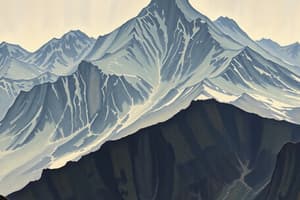
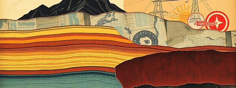
The Structure of the Earth
- The Earth is structured with layers of varying composition, temperature, and physical state.
- Understanding this structure is crucial for geology, plate tectonics, and Earth's geophysical processes.
Earth's Layers
- Crust: The outermost solid layer, varies in thickness from 6-90 km, thicker under continents and thinner under oceans.
- It is the upper part of the lithosphere, including the crust and solid upper mantle.
- The crust is divided into tectonic plates that float on the semifluid upper mantle.
- Mantle: Located directly beneath the crust, extending approximately 2,900 km downward.
- Composed of solid but plastic-like rock, capable of flow.
- Temperatures can reach up to 5,000°C.
- The boundary between the crust and mantle is the Mohorovičić discontinuity (Moho).
- Outer Core: A liquid layer about 2,250 km thick, beneath the mantle.
- Primarily composed of nickel (Ni) and iron (Fe).
- Its fluid nature results from extremely high temperatures.
- Inner Core: The deepest layer, approximately 1,200 km thick.
- Remains solid due to immense pressure, despite extreme heat.
The Rock Cycle
- Describes the transformation of rock types through geological time.
- Driven by Earth's internal and surface processes.
Processes in the Rock Cycle
- Formation of Igneous Rock: Magma rises and cools, either on the surface as lava or below the surface as intrusive bodies.
- Cooling rate affects crystal size, with slower cooling forming larger crystals.
- Formation of Sedimentary Rock: Weathering breaks down existing rock into sediments.
- Sediments are transported, deposited, compacted, and solidified into sedimentary rock.
- Formation of Metamorphic Rock: Existing rocks transform under extreme pressure and temperature without melting.
- Alters the mineral composition and structure of the rock.
Intrusive Igneous Activity
- Magma cools and solidifies below ground, forming intrusive rock bodies.
Types of Intrusive Bodies
- Batholiths: Large masses of igneous rock formed deep below the surface and exposed by erosion.
- Laccoliths and Lopoliths: Smaller intrusions shaped by magma between rock layers, causing uplift (laccoliths) or sagging (lopoliths).
- Dykes and Sills: Magma fills cracks and solidifies; dykes are vertical, sills are horizontal.
- Pipes: Chimney-like structures allowing magma to move towards the surface.
Major Factors Shaping Landscapes
- Landscapes are influenced by geological structures and the type of rock present.
- Which determines resistance to erosion and permeability.
Impact of Rock Types on Landforms
- Sedimentary Rock Landforms: Features like karst landscapes (caves, springs, aquifers) formed in limestone.
- Igneous Rock Landforms: Notable for formations like tors (residual landforms from erosion).
- Each layer of the Earth and type of rock plays a distinct role in shaping our planet's physical landscape and geological activity, influencing everything from mountain formation to the occurrence of earthquakes.
Continental Drift
- Proposed by Alfred Wegener in 1923, suggesting that continents were once a single supercontinent called Pangaea.
- Pangaea existed about 200 million years ago, then fragmented into Laurasia and Gondwana around 135 million years ago. -These landmasses further split into today's continents, which continue to drift due to tectonic forces.
Evidence Supporting Continental Drift
- Jigsaw Fit: Alignment of South America's east coast and Africa's west coast at certain depths.
- Geology and Fossils: Similar rock formations and fossils across continents like Africa and South America.
- Glacial Deposits: Matching glacial traces in Brazil and West Africa.
- Coal Deposits: Coal in similar geological layers across Antarctica, South America, India, Africa, and Australia.
- Distribution of Fossils: Fossils of Lystrosaurus across continents separated by oceans.
Plate Tectonics
- The Earth's lithosphere is divided into tectonic plates.
- Plates float over the semifluid asthenosphere (upper mantle).
- Driven by mantle convection currents, plates move up to 30 cm per year.
Plate Margins
- Plate margins are sites of significant geological activity.
Constructive Margins (Divergent)
- Plates move apart, magma rises and solidifies, forming new crust and midocean ridges.
- Often accompanied by mild volcanic activity and earthquakes.
- Example: Mid-Atlantic Ridge.
Destructive Margins (Convergent)
- An oceanic plate subducts under a continental plate, creating deep-sea trenches and volcanic island arcs.
- Can trigger violent earthquakes and volcanic eruptions.
- Example: Japan.
Conservative Margins (Transform)
- Plates slide past each other without creating or destroying crust.
- Sticking plates can cause pressure buildup, leading to severe earthquakes when they slip.
- Example: San Andreas Fault, California.
Collision Margins
- Two continental plates collide, pushing material upward to form mountain ranges.
- Often causes strong earthquakes but no volcanic activity.
- Example: Himalayas.
Volcanic and Earthquake Zones
- Monitoring tremors and changes in landform shape can help with earthquake prediction.
- Instruments measure rock tension.
- Unusual animal behavior and changes in coastal water levels can be observed.
- Infrastructure can be strengthened, and tsunami warning systems can be implemented in vulnerable areas.
- Ground temperature, gas emissions, and physical changes in volcanoes can be monitored.
- Tilt meters detect slope changes.
- Robust warning and evacuation procedures manage volcanic threats.
- Plate tectonics significantly influence geological landscape, affecting everything from mountain formation to seismic activity; understanding these processes is key to mitigating risks associated with natural disasters and studying geodynamic evolution.
Formation of Folds
- Folds are created when rock layers are subjected to intense pressure.
- Typically at colliding tectonic plate boundaries.
- Sedimentary rocks are most prone to folding.
- Immense pressure causes rocks to buckle and fold.
- Can result in simple or complex fold structures.
- Large-scale folding forms fold mountains like the Himalayas.
- The type and intensity of folding depend on the properties of the rock and the magnitude of the compressive forces.
Types of Folds
- Overthrust Fold (Nappe): Rock folds, breaks, and slides over itself under extreme pressure.
- Recumbent Fold: Limbs are nearly horizontal, forming under very high pressure.
- Overfold: Similar to an anticline but with a steeply inclined limb.
- Monocline: A simple, step-like fold where rock layers tilt in one direction.
- Syncline and Anticline: Synclines are downward U-shaped folds; anticlines are upward arch-like folds.
Fold Mountains
- Formed from the folding of the Earth's crust at convergent plate boundaries.
- Examples include the Alps, Rockies, Himalayas, and the Cape Fold Belt in South Africa.
- Agriculture: Suitable for grazing; terrace farming is common on the slopes.
- Tourism: Destinations for ecotourism, skiing and related activities.
- Energy: Rivers flowing through mountains are often harnessed for hydroelectric power.
Faulting
- Faulting happens when rocks fracture due to tectonic forces.
- Fractured rock layers may slide past each other, causing earthquakes.
- Tension: Rocks being pulled apart, leading to normal faults.
- Compression: Rocks being pushed together, leading to reverse faults or folds.
- Lateral Forces: Horizontal movement causing strike-slip faults (e.g., San Andreas Fault).
Landforms Associated with Faults
- Block Mountains (Horsts): Elevated blocks formed between faults.
- Rift Valleys (Grabens): Depressed blocks created by fault movements, such as the East African Rift Valley.
- Many fault-related landscapes are tourist attractions due to their dramatic scenery and unique geological features.
- Folding and faulting are dynamic processes which has significant impact on the earth's ecological systems and human activities.
- Understanding these processes is crucial for managing natural resources and mitigating natural disasters like earthquakes.
Formation of Earthquakes
- Earthquakes are caused by the movement of tectonic plates at fault lines.
- Plates slide past each other or one plate moves under another.
- Can also be caused by internal activities like mine collapses.
Measurement and Recording of Earthquakes
- Seismic Waves: Shock waves radiating from the earthquake focus.
- Seismograph: Instrument measuring seismic waves.
- Seismogram: Recorded graph depicting seismic wave strength and duration.
- Focus: Point inside the Earth where the earthquake originates.
- Epicenter: Point on the surface directly above the focus.
Earthquake Waves
- Primary Waves (P-waves): Fastest waves; travel through the Earth's crust, squeezing or stretching the ground.
- Secondary Waves (S-waves): Move ground up, down, and sideways; only through solids.
- Surface Waves: Slowest but most destructive; roll the ground like ocean waves.
Tsunami
- A series of ocean waves is caused by undersea disturbances like earthquakes, volcanic activity, or landslides.
- An undersea earthquake lifts or lowers the ocean floor.
- Water displacement creates waves that travel outward.
- Approaching shallow coasts, waves slow and grow in height, causing coastal flooding.
Strength of Earthquakes
- Measured using the Richter scale which quantifies energy released.
- Minor: 0-4.9, often felt but with rare damage.
- Moderate to Strong: 5-6.9, can damage buildings and structures.
- Major to Great: Above 7, can cause serious to catastrophic damage.
Effects of Earthquakes
- Infrastructure Damage: Destruction of buildings, roads, bridges, and utility lines.
- Resource Shortages: Disruption of water, gas, and electricity supplies.
- Health and Safety Risks: Increased risk of diseases, injuries from debris, and secondary disasters like fires.
Impact on Developing vs. Developed Countries
- Developed countries have better infrastructure and preparedness.
- Developing countries may suffer greater devastation.
Preparedness Initiatives
- Advanced Warning Systems: Earthquake early warning systems can mitigate damage.
- Infrastructure Resilience: Enhancing infrastructure to withstand earthquake forces.
- Community Preparedness: Training and resources for local communities to respond effectively.
- Understanding earthquakes involves studying their origins, measuring their strength, and mitigating their effects through preparedness and response strategies.
- Effective management and planning can significantly reduce the risks associated with earthquakes, especially in regions prone to seismic activity.
Formation of Volcanoes
- Volcanoes form due to molten rock (magma) rising from beneath the Earth’s surface.
- Magma Formation: In the mantle or lower crust due to pressure, heat, or water.
- Rise Through Cracks: Magma ascends through cracks or pipes.
- Magma Chamber: Magma pools near the surface.
- Eruption Through Vents: Magma pushes through a vent, becoming lava.
- Multiple Vents: Volcanoes can have multiple vents or pipes.
Classification of Volcanoes
- Active Volcanoes: Erupted recently and likely to erupt again.
- Example: Anak Krakatau - which erupted in 2007
- Dormant Volcanoes: Erupted in the past and could erupt again but show no recent activity.
- Example: Fujiyama in Japan
- Extinct Volcanoes: Not erupted in recorded history and not expected to erupt again.
- Example: Mount Kenya
Types of Volcanoes
- Cinder Cone Volcanoes: Simplest type, formed by explosive eruptions.
- Example: Monte Nuovo in Italy
- Shield Volcanoes: Gentle slopes formed by effusive, low-viscosity lava flow over great distances.
- Example: Mauna Loa in Hawaii
- Composite Volcanoes (Stratovolcanoes): Multiple layers of hardened lava, ash, and rock debris from successive explosive eruptions.
- Steep, conical shapes.
- Examples: Vesuvius in Italy and Fujiyama in Japan
Impacts of Volcanoes on People
- Tourism: Volcanic features attract tourists and boost local economies.
- Agriculture: Volcanic soils are fertile.
- Mineral Resources: Volcanic areas can be rich in minerals and gems.
- Health and Safety Risks: Eruptions release harmful gases and ash.
- Water Pollution: Volcanic ash can contaminate water supplies.
- Property Damage: Lava flows and mudflows can destroy settlements and infrastructure.
- Volcanoes play a complex role in Earth’s geology and human civilization, they are powerful natural features that can create and destroy habitats, alter landscapes, and significantly impact climate patterns.
- Understanding their formation, types, and effects helps in mitigating risks and harnessing the benefits associated with volcanic regions.
Studying That Suits You
Use AI to generate personalized quizzes and flashcards to suit your learning preferences.