Podcast
Questions and Answers
The lithosphere is broken into a number of plates known as the ______ plates.
The lithosphere is broken into a number of plates known as the ______ plates.
Lithospheric
The forces which act on the interior of the earth are called ______ forces.
The forces which act on the interior of the earth are called ______ forces.
Endogenic
The forces that work on the surface of the earth are called ______ forces.
The forces that work on the surface of the earth are called ______ forces.
Exogenic
[Blank] forces sometimes produce sudden movements like earthquakes and volcanoes.
[Blank] forces sometimes produce sudden movements like earthquakes and volcanoes.
A ______ is a vent (opening) in the earth's crust through which molten material erupts suddenly.
A ______ is a vent (opening) in the earth's crust through which molten material erupts suddenly.
The place in the crust where the movement starts during an earthquake is called the ______.
The place in the crust where the movement starts during an earthquake is called the ______.
The place on the surface above the focus is called the ______.
The place on the surface above the focus is called the ______.
An earthquake is measured with a machine called a ______.
An earthquake is measured with a machine called a ______.
The magnitude of an earthquake is measured on the ______ scale.
The magnitude of an earthquake is measured on the ______ scale.
[Blank] is the breaking up of rocks on the earth's surface.
[Blank] is the breaking up of rocks on the earth's surface.
[Blank] is the wearing away of the landscape by different agents like water, wind, and ice.
[Blank] is the wearing away of the landscape by different agents like water, wind, and ice.
When a river tumbles at a steep angle over very hard rocks, it forms a ______.
When a river tumbles at a steep angle over very hard rocks, it forms a ______.
As a river enters the plain, it twists and turns forming large bends known as ______.
As a river enters the plain, it twists and turns forming large bends known as ______.
When the meander loop cuts off from the river, it forms a cut-off lake, also called an ______ lake.
When the meander loop cuts off from the river, it forms a cut-off lake, also called an ______ lake.
The raised banks along a river are called ______.
The raised banks along a river are called ______.
When a river breaks up into a number of streams, these streams are called ______.
When a river breaks up into a number of streams, these streams are called ______.
The collection of sediments from all the mouths of a river forms a ______.
The collection of sediments from all the mouths of a river forms a ______.
The erosion and deposition of sea waves gives rise to coastal ______
The erosion and deposition of sea waves gives rise to coastal ______
Hollow-like caves formed on rocks by sea waves are called ______.
Hollow-like caves formed on rocks by sea waves are called ______.
When only the roof of sea caves remains, they form sea ______.
When only the roof of sea caves remains, they form sea ______.
After erosion breaks the roof of sea arches, the wall-like features left are called ______.
After erosion breaks the roof of sea arches, the wall-like features left are called ______.
The steep rocky coast rising almost vertically above sea water is called a ______.
The steep rocky coast rising almost vertically above sea water is called a ______.
[Blank] is often described as 'rivers of ice'.
[Blank] is often described as 'rivers of ice'.
The material carried by a glacier, such as rocks and sand, forms ______ when deposited.
The material carried by a glacier, such as rocks and sand, forms ______ when deposited.
Rocks in the shape of a mushroom, commonly called mushroom rocks, are found in ______
Rocks in the shape of a mushroom, commonly called mushroom rocks, are found in ______
Low hill-like structures formed when wind deposits sand are called ______
Low hill-like structures formed when wind deposits sand are called ______
When very fine and light sand is deposited in large areas, it is called ______
When very fine and light sand is deposited in large areas, it is called ______
The movement of molten ______ inside the earth causes the lithospheric plates to move.
The movement of molten ______ inside the earth causes the lithospheric plates to move.
[Blank] are endogenic forces that cause sudden movements on Earth's surface.
[Blank] are endogenic forces that cause sudden movements on Earth's surface.
Damage from an earthquake is usually greatest closest to the ______.
Damage from an earthquake is usually greatest closest to the ______.
An earthquake with a magnitude of 7.0 or higher on the Richter scale is classified as a ______ earthquake.
An earthquake with a magnitude of 7.0 or higher on the Richter scale is classified as a ______ earthquake.
The process of ______ involves the transport of eroded material by agents like water and wind.
The process of ______ involves the transport of eroded material by agents like water and wind.
Floodplains are formed by the deposition of ______ during flooding events.
Floodplains are formed by the deposition of ______ during flooding events.
The formation of sea caves, sea arches, and stacks are primarily due to the erosion caused by sea ______.
The formation of sea caves, sea arches, and stacks are primarily due to the erosion caused by sea ______.
[Blank] carve out deep hollows in the landscape, which can then fill with water to become lakes.
[Blank] carve out deep hollows in the landscape, which can then fill with water to become lakes.
[Blank] are formed when wind erodes the lower section of rocks, leaving them with a narrower base and wider top.
[Blank] are formed when wind erodes the lower section of rocks, leaving them with a narrower base and wider top.
The river becomes so slow that it begins to deposit its load, each ______ forms its own mouth.
The river becomes so slow that it begins to deposit its load, each ______ forms its own mouth.
The earth’s crust consists of several large and some small, rigid, irregularly-shaped plates (______).
The earth’s crust consists of several large and some small, rigid, irregularly-shaped plates (______).
An earthquake is measured with a machine called a ______. The magnitude of the earthquake is measured on the Richter ______.
An earthquake is measured with a machine called a ______. The magnitude of the earthquake is measured on the Richter ______.
Sudden movements like ______ and ______ cause mass destruction over the surface of the earth.
Sudden movements like ______ and ______ cause mass destruction over the surface of the earth.
Flashcards
Lithospheric Plates
Lithospheric Plates
The earth's crust broken into plates.
Endogenic Forces
Endogenic Forces
Forces from within the Earth.
Exogenic Forces
Exogenic Forces
Forces on the Earth's surface.
Earthquake
Earthquake
Signup and view all the flashcards
Volcano
Volcano
Signup and view all the flashcards
Focus
Focus
Signup and view all the flashcards
Epicentre
Epicentre
Signup and view all the flashcards
Seismograph
Seismograph
Signup and view all the flashcards
Richter Scale
Richter Scale
Signup and view all the flashcards
Weathering
Weathering
Signup and view all the flashcards
Erosion
Erosion
Signup and view all the flashcards
Waterfall
Waterfall
Signup and view all the flashcards
Meanders
Meanders
Signup and view all the flashcards
Ox-bow lake
Ox-bow lake
Signup and view all the flashcards
Floodplain
Floodplain
Signup and view all the flashcards
Levees
Levees
Signup and view all the flashcards
Distributaries
Distributaries
Signup and view all the flashcards
Sea Caves
Sea Caves
Signup and view all the flashcards
Sea Arches
Sea Arches
Signup and view all the flashcards
Stacks
Stacks
Signup and view all the flashcards
Sea Cliff
Sea Cliff
Signup and view all the flashcards
Glaciers
Glaciers
Signup and view all the flashcards
Glacial Moraines
Glacial Moraines
Signup and view all the flashcards
Sand Dunes
Sand Dunes
Signup and view all the flashcards
Mushroom Rocks
Mushroom Rocks
Signup and view all the flashcards
Loess
Loess
Signup and view all the flashcards
Study Notes
- The lithosphere is divided into lithospheric plates.
- These plates move very slowly, only a few millimeters each year.
- The movement is due to the molten magma inside the earth moving in a circular manner.
- The movement of these plates results in changes to the surface.
- Earth movements are divided based on the forces that cause them.
- Endogenic forces act in the interior of the earth.
- Exogenic forces work on the surface of the earth.
Endogenic Forces
- Endogenic forces can cause sudden movements or slow movements.
- Sudden movements include earthquakes and volcanoes, which can cause mass destruction.
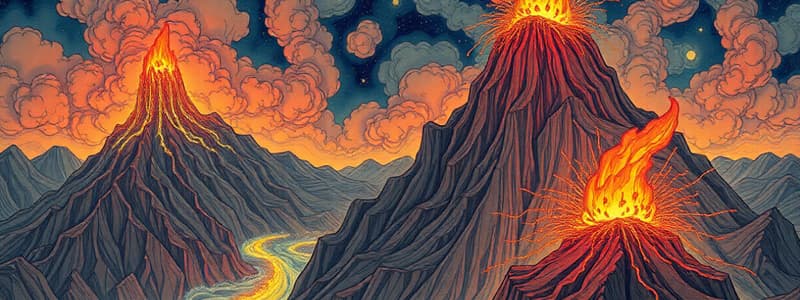
Volcanoes
- A volcano is a vent (opening) in the earth's crust.
- Molten material erupts suddenly through this opening.
Earthquakes
- Earthquakes are vibrations on the surface of the earth caused by the movement of lithospheric plates.
- The vibrations travel all around the earth.
- The focus is the place in the crust where the movement starts.
- The epicentre is the place on the surface above the focus.
- Vibrations travel outwards from the epicentre as waves.
- Greatest damage occurs closest to the epicentre.
- The strength of the earthquake decreases away from the centre.
- There are three types of earthquake waves: P waves or longitudinal waves, S waves or transverse waves, and L waves or surface waves.
- Earthquakes cannot be predicted but the impact can be minimised if we are prepared.
- Locally, some earthquake prediction methods include studying animal behaviour, such as fish becoming agitated and snakes surfacing.
Measuring Earthquakes
- An earthquake is measured using a seismograph.
- The magnitude of the earthquake is measured on the Richter scale.
- Magnitude 2.0 or less is felt only a little.
- Magnitude over 5.0 can cause damage from things falling.
- Magnitude 6.0 or higher is considered very strong.
- Magnitude 7.0 is classified as a major earthquake.
Earthquake Preparedness
- The safest places to take shelter during an earthquakes are under a kitchen counter, table, or desk, against an inside corner or wall.
- Stay away from fireplaces, areas around chimneys, and windows that shatter.
- People should spread awareness and face disasters confidently.
Major Landforms
- The landscape is continuously worn away by weathering and erosion.
- Weathering is the breaking up of rocks on the earth's surface.
- Erosion is the wearing away of the landscape by different agents such as water, wind, and ice.
- Eroded material is carried away or transported and eventually deposited.
- Erosion and deposition create different landforms on the surface of the earth.
Work of a River
- Running water in a river erodes the landscape.
- Waterfalls are formed when a river tumbles at a steep angle over hard rocks or down a steep valley side.
- As a river enters the plain, it twists and turns, forming large bends called meanders.
- Continuous erosion and deposition along the sides of the meander cause the ends to come closer.
- Over time, the meander loop cuts off from the river and forms a cut-off lake, also called an ox-bow lake.
- When a river overflows its banks, it leads to flooding and deposits layers of fine soil and sediments, forming a flat fertile floodplain.
- The raised banks are called levees.
- As the river approaches the sea, it breaks up into a number of streams called distributaries, becomes slow, and deposits its load.
- Each distributary forms its own mouth, with all mouths forming a delta.
Work of Sea Waves
- The erosion and deposition of the sea waves gives rise to coastal landforms.
- Sea caves are formed when waves continuously strike rocks, causing cracks to develop.
- Sea arches are formed when the roof of sea caves collapses.
- Stacks are formed when further erosion breaks the roof of sea arches, leaving only walls.
- Sea cliffs are steep rocky coasts rising almost vertically above sea water.
- Sea waves deposit sediments along the shores, forming beaches.
Work of Ice
- Glaciers, or "rivers of ice," erode the landscape by bulldozing soil and stones.
- Glaciers carve out deep hollows that fill up with water when the ice melts, forming lakes.
- Materials carried by glaciers, such as rocks, sand, and silt, are deposited as glacial moraines.
Work of Wind
- Wind is an active agent of erosion and deposition in deserts.
- Mushroom rocks are formed when winds erode the lower section of rocks more than the upper part.
- Sand dunes are low hill-like structures formed when wind transports and deposits sand.
- Loess is formed when fine and light sand is carried over long distances and deposited in large areas; large deposits are found in China.
Studying That Suits You
Use AI to generate personalized quizzes and flashcards to suit your learning preferences.


