Podcast
Questions and Answers
What can be a primary factor in deciding which drone model to select?
What can be a primary factor in deciding which drone model to select?
- The drone's durability and wind resistance
- The drone's size and weight
- The drone's battery life and image resolution (correct)
- The drone's price and brand reputation
What technology allows scanning an area with a laser beam to create a point cloud from millions of pieces of spatial data?
What technology allows scanning an area with a laser beam to create a point cloud from millions of pieces of spatial data?
- 3D modeling software
- GPS technology
- Surveying software
- 3D laser scanners (correct)
What was the number of data points captured by a professor and historian in a 2010 project for France's Notre Dame Cathedral?
What was the number of data points captured by a professor and historian in a 2010 project for France's Notre Dame Cathedral?
- 10 million data points
- 500 million data points
- 100 million data points
- 1 billion data points (correct)
What is one benefit of using 3D laser scanners in construction?
What is one benefit of using 3D laser scanners in construction?
What is one advantage of using drones in construction?
What is one advantage of using drones in construction?
What was the purpose of using the laser scanning data in the Notre Dame Cathedral restoration project?
What was the purpose of using the laser scanning data in the Notre Dame Cathedral restoration project?
What is the primary benefit of using 3D laser scanners in surveying?
What is the primary benefit of using 3D laser scanners in surveying?
What is the projected global value of the terrestrial laser scanner market by the end of the forecast period?
What is the projected global value of the terrestrial laser scanner market by the end of the forecast period?
What is the primary purpose of the device created by OpenSpace?
What is the primary purpose of the device created by OpenSpace?
What is the potential benefit of using robots in surveying?
What is the potential benefit of using robots in surveying?
What is the compound annual growth rate (CAGR) of the terrestrial laser scanner market?
What is the compound annual growth rate (CAGR) of the terrestrial laser scanner market?
What is the name of the robot dog developed by Boston Dynamics?
What is the name of the robot dog developed by Boston Dynamics?
Flashcards are hidden until you start studying
Study Notes
Advantages of 3D Laser Scanners
- 3D laser scanners enable surveyors to save time by using specialized tools to draw repeating patterns and reduce labor needed for preparing data.
- This allows professional surveyors to focus on examining the outcomes of their topographical analyses rather than formatting information.
Market Outlook for Terrestrial Laser Scanners
- The global value of the terrestrial laser scanner market is expected to reach $6.12 billion by 2027.
- This represents a compound annual growth rate (CAGR) of 8.25%.
Automation in Surveying
- Inspectors conducting manual topographic surveys can take hundreds or thousands of photos in a week, requiring organization and filing for actionable insights.
- Some construction companies use tools to automate parts of the process, such as OpenSpace's device that mounts to a hard hat and takes 360-degree images while walking around a site.
- The images are automatically mapped to a site's floor plan, allowing users to quickly understand how an image relates to space and time.
Robotics and Surveying
- Boston Dynamics' robot dog, Spot, has been used in surveying, with software teaching the machine to autonomously move through a site.
- This could free humans from manual surveying, giving them more time for other tasks.
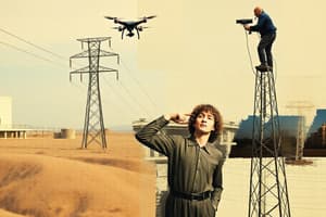
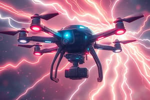
Drones in Surveying
- Drones can provide reliable images, especially in sites that pose dangers for surveying data collection.
- Users must consider factors such as a drone's battery life and image resolution when selecting a model.
Laser Scanners in Construction and Preservation
- 3D laser scanners can provide dependable information without delays, allowing for quick and accurate data capture.
- This technology has been used in preserving historical sites, such as France's Notre Dame Cathedral, where 1 billion data points were captured over five days in 2010.
Studying That Suits You
Use AI to generate personalized quizzes and flashcards to suit your learning preferences.