Podcast
Questions and Answers
What is the recommended shutter speed for capturing images during the flight?
What is the recommended shutter speed for capturing images during the flight?
- 1/1000 sec (correct)
- 1/500 sec
- 1/2000 sec
- 1/250 sec
What is the advised interval for taking photos during the acquisition process?
What is the advised interval for taking photos during the acquisition process?
- 5 seconds
- 2 seconds (correct)
- 1 second
- 3 seconds
Why is it important to tilt the camera at a 45° angle?
Why is it important to tilt the camera at a 45° angle?
- To reduce motion blur in images
- To capture better 3D data (correct)
- To fit more of the scene into the frame
- To comply with flight regulations
When flying at 150 ft, what is the expected benefit?
When flying at 150 ft, what is the expected benefit?
What temperature management strategy is recommended for the phone during flight?
What temperature management strategy is recommended for the phone during flight?
What is the proper setting for the histogram during the camera setup?
What is the proper setting for the histogram during the camera setup?
What percentage of the building should ideally appear in the frame for better context in images?
What percentage of the building should ideally appear in the frame for better context in images?
What should be checked regarding battery voltage to ensure safety during landing?
What should be checked regarding battery voltage to ensure safety during landing?
What follows after completing one orbit around the building?
What follows after completing one orbit around the building?
Which parameter needs to be adjusted prior to flying for the detailed package?
Which parameter needs to be adjusted prior to flying for the detailed package?
The shutter priority should be set to 1/2000 sec for optimal image capture.
The shutter priority should be set to 1/2000 sec for optimal image capture.
Tilting the camera at a 90° angle is recommended for capturing 3D data.
Tilting the camera at a 90° angle is recommended for capturing 3D data.
To maintain optimal performance, the battery voltage should be around 3.8 volts.
To maintain optimal performance, the battery voltage should be around 3.8 volts.
For a successful detailed package mission, it is necessary to perform additional orbits around the building.
For a successful detailed package mission, it is necessary to perform additional orbits around the building.
In orbit flying, movement of the roll stick initiates circular motion while the yaw stick helps maintain orbit direction.
In orbit flying, movement of the roll stick initiates circular motion while the yaw stick helps maintain orbit direction.
Flashcards are hidden until you start studying
Study Notes
Camera Setup and Flight Preparation
- Use DJI Go 4 for orbit flying.
- Adjust camera settings:
- File format set to JPEG.
- White balance configured for sunny conditions.
- Photo style set to time shot with a 2-second interval.
- Ensure histogram and file index mode are set to continuous for effective data acquisition.
Flight Execution
- Tilt camera to a 45° angle using the blue circle indicator next to the shutter button; this is integral for capturing 3D data.
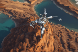
- Flying at a higher elevation (recommended at 150 ft) reduces data acquisition time.
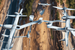
- For orbital flying:
- First, move the roll stick to start the circular motion.
- Use the yaw stick in the opposite direction to maintain orbit.
- Initiate photo capture by pressing the shutter button.
Data Capture Strategy
- Aim for 20-30% of the building to appear in the frame for better context in images.
- Maintain battery voltage around 3.6 volts for optimal performance and landing safety.
- Take note of the phone's temperature; avoid overheating by keeping it in the shade.
Recap of Acquisition Process
- Camera setup included:
- Shutter priority set to 1/1000 sec.
- Photo mode set for capture every 2 seconds.
- After elevating to 150 ft, initiate the shutter to start capturing images.
- Perform one complete orbit around the building, capturing necessary data with specific overlaps (80% forward and 80% side).
Transition to Detailed Package
- For the detailed package, replace the battery and configure a double grid mission.
- The same elevation and overlap specifications apply to the detailed package.
- Reuse existing orbital data without the need for additional orbits.
- Set up mission parameters in the shade to conserve battery power prior to flight.
Camera Setup and Flight Preparation
- DJI Go 4 is utilized for executing orbit flying missions.
- Configure camera settings:
- File format is preset to JPEG for optimal image quality.
- White balance should be adjusted for sunny conditions to enhance color accuracy.
- Photo style is configured for time shots with a 2-second interval to capture sequential images.
- Ensure histogram and file index mode are on continuous to facilitate effective data collection.
Flight Execution
- Camera tilt should be set to a 45° angle, crucial for capturing comprehensive 3D data representations.
- Recommended flying altitude is 150 ft, which aids in reducing data acquisition time substantially.
- To initiate orbital flying:
- Roll stick movement commences circular motion around the target object.
- Use yaw stick in the opposite direction to maintain a balanced orbit.
- Capture photos by pressing the shutter button when ready.
Data Capture Strategy
- Ensure 20-30% of the building is featured in the frame for better contextual information in images.
- Maintain battery voltage around 3.6 volts to ensure optimal drone performance and safe landing.
- Monitor the phone’s temperature closely; avoid overheating by keeping it shaded during flight operations.
Recap of Acquisition Process
- Camera settings include:
- Shutter priority fixed at 1/1000 sec for crisp images.
- Photo mode is configured to take captures every 2 seconds.
- Upon reaching 150 ft altitude, initiate the shutter to begin the image capture.
- Complete one orbit around the building, ensuring 80% overlap in both forward and side directions for comprehensive data acquisition.
Transition to Detailed Package
- For detailed data packages, replace the drone's battery and set up a double grid mission.
- Maintain the same elevation (150 ft) and overlap requirements as with the initial data acquisition.
- Utilize existing orbital data without the necessity of additional orbiting.
- Set mission parameters in a shaded area to conserve battery life before commencing the flight.
Studying That Suits You
Use AI to generate personalized quizzes and flashcards to suit your learning preferences.