Podcast
Questions and Answers
Which characteristic distinguishes Laroy Falls from other waterfalls mentioned?
Which characteristic distinguishes Laroy Falls from other waterfalls mentioned?
- Its location near Lubo and Mangali Rice Terraces.
- Its icy-cold and crystal-clear waters.
- Its accessibility via hunter's trails.
- Its composition of at least 8 different cascades. (correct)
Considering the geographic location of Apayao, which neighboring province does NOT share a border with it?
Considering the geographic location of Apayao, which neighboring province does NOT share a border with it?
- Ilocos Norte
- Isabela (correct)
- Abra
- Cagayan
If a tourist is in Tuguegarao and wants to visit Dupag Rock Formation, what mode of transportation is required after arriving at Junction Luna?
If a tourist is in Tuguegarao and wants to visit Dupag Rock Formation, what mode of transportation is required after arriving at Junction Luna?
- Bus
- Van
- Tricycle (correct)
- Jeepney
Based on the climate information, during which months would be the least ideal time to visit Apayao for someone wanting to avoid heavy rain?
Based on the climate information, during which months would be the least ideal time to visit Apayao for someone wanting to avoid heavy rain?
What geological feature are the Buaya Caves best known for?
What geological feature are the Buaya Caves best known for?
What protective measure is specifically advised for tourists planning to visit Dupag Rock Formation, and why?
What protective measure is specifically advised for tourists planning to visit Dupag Rock Formation, and why?
Lubo and Mangali Rice Terraces are advantageous due to their location. What does their location provide?
Lubo and Mangali Rice Terraces are advantageous due to their location. What does their location provide?
What is the best way to summarize the appeal of Father Rock, located in Apayao?
What is the best way to summarize the appeal of Father Rock, located in Apayao?
Why was the name 'Cordillera' given to the mountain range in Northern Luzon by the Spanish conquistadors?
Why was the name 'Cordillera' given to the mountain range in Northern Luzon by the Spanish conquistadors?
Which statement best describes the relationship between the Igorot people and the Cordillera region?
Which statement best describes the relationship between the Igorot people and the Cordillera region?
Which of the following economic activities is most prevalent among the population of the Cordillera Administrative Region?
Which of the following economic activities is most prevalent among the population of the Cordillera Administrative Region?
Besides the Banaue Rice terraces, which other locations from the Cordillera Administrative Region are noted as tourist attractions?
Besides the Banaue Rice terraces, which other locations from the Cordillera Administrative Region are noted as tourist attractions?
What is a distinctive geographical characteristic of the Cordillera Administrative Region (CAR) within the Philippines?
What is a distinctive geographical characteristic of the Cordillera Administrative Region (CAR) within the Philippines?
Mount Pulag is notable for being the highest mountain in Luzon. In which of the following categories does Mount Pulag belong to within the Cordillera Administrative Region?
Mount Pulag is notable for being the highest mountain in Luzon. In which of the following categories does Mount Pulag belong to within the Cordillera Administrative Region?
If a tourist wants to see the Banaue Rice Terraces, which province should they visit?
If a tourist wants to see the Banaue Rice Terraces, which province should they visit?
Which combination of metallic ores are found in abundance in the Cordillera Administrative Region?
Which combination of metallic ores are found in abundance in the Cordillera Administrative Region?
Which characteristic of Lussok Cave is LEAST important for attracting tourists focused on unique natural formations?
Which characteristic of Lussok Cave is LEAST important for attracting tourists focused on unique natural formations?
If a tour operator aims to highlight the biodiversity of Apayao River alongside recreational activities, which aspect should they emphasize LEAST?
If a tour operator aims to highlight the biodiversity of Apayao River alongside recreational activities, which aspect should they emphasize LEAST?
Gololan Falls is promoted as a prime location for adventure tourism. Which feature is LEAST relevant to this promotion?
Gololan Falls is promoted as a prime location for adventure tourism. Which feature is LEAST relevant to this promotion?
Which of the following is the MOST LIKELY reason Benguet experiences crop damage due to frost?
Which of the following is the MOST LIKELY reason Benguet experiences crop damage due to frost?
A researcher is studying the cultural distribution in Benguet. Which approach would be the LEAST effective in gathering initial data?
A researcher is studying the cultural distribution in Benguet. Which approach would be the LEAST effective in gathering initial data?
A government agency is tasked with creating a sustainable tourism plan for Apayao. Which strategy would be LEAST effective in preserving the natural environment?
A government agency is tasked with creating a sustainable tourism plan for Apayao. Which strategy would be LEAST effective in preserving the natural environment?
Which conservation effort would MOST directly address the issue of crop damage from seasonal frost in Benguet?
Which conservation effort would MOST directly address the issue of crop damage from seasonal frost in Benguet?
How do the geographical characteristics of Benguet MOST influence its economic activities?
How do the geographical characteristics of Benguet MOST influence its economic activities?
Which culinary practice is most likely a direct adaptation to the mountainous geography of the Cordillera Administrative Region?
Which culinary practice is most likely a direct adaptation to the mountainous geography of the Cordillera Administrative Region?
Considering Abra's geography, what impact does the Abra River most likely have on the province's agriculture and transportation?
Considering Abra's geography, what impact does the Abra River most likely have on the province's agriculture and transportation?
How might the cultural backgrounds of Abra's inhabitants influence the local cuisine?
How might the cultural backgrounds of Abra's inhabitants influence the local cuisine?
What can be inferred about the accessibility of Abra based on the provided travel information?
What can be inferred about the accessibility of Abra based on the provided travel information?
Given the cultural significance of glutinous rice in Kalinga, what does the serving of inanchila, kinalloray, and sapurado during special occasions suggest about their role in the community?
Given the cultural significance of glutinous rice in Kalinga, what does the serving of inanchila, kinalloray, and sapurado during special occasions suggest about their role in the community?
Considering the mention of 'binanayan', 'pinalatan', and 'pinaltit' pizza in Apayao, what does this suggest about the evolution of the region's cuisine?
Considering the mention of 'binanayan', 'pinalatan', and 'pinaltit' pizza in Apayao, what does this suggest about the evolution of the region's cuisine?
If Ifugao primarily produces smoked longganisa ('pinunnog'), what economic opportunities could this present for the province?
If Ifugao primarily produces smoked longganisa ('pinunnog'), what economic opportunities could this present for the province?
Based on the geographical description, what challenges might Abra face in terms of infrastructure development and transportation?
Based on the geographical description, what challenges might Abra face in terms of infrastructure development and transportation?
A tourist plans to visit both Mt. Pulag for the sunrise and the Asin Hot Spring in a single day. Considering travel time and optimal viewing conditions, what would be the most logical order to visit these locations?
A tourist plans to visit both Mt. Pulag for the sunrise and the Asin Hot Spring in a single day. Considering travel time and optimal viewing conditions, what would be the most logical order to visit these locations?
A traveler wants to experience the 'Switzerland of Benguet' during the rainy season. What unique feature can they expect to see in Tacadang during this time?
A traveler wants to experience the 'Switzerland of Benguet' during the rainy season. What unique feature can they expect to see in Tacadang during this time?
A group of hikers is planning a trip to one of Benguet's waterfalls for recreational swimming. Based on the descriptions, which waterfall is most suitable for swimming in deep pools?
A group of hikers is planning a trip to one of Benguet's waterfalls for recreational swimming. Based on the descriptions, which waterfall is most suitable for swimming in deep pools?
A historian is researching the significance behind the name of Shamsham Falls. What historical event does the name 'ninety-nine' commemorate?
A historian is researching the significance behind the name of Shamsham Falls. What historical event does the name 'ninety-nine' commemorate?
A traveler flying into Benguet wishes to land as close to Baguio City as possible. Which airport should they target, and what are the limitations of this airport?
A traveler flying into Benguet wishes to land as close to Baguio City as possible. Which airport should they target, and what are the limitations of this airport?
A tourist wants to visit a place that resembles the Grand Canyon of the United States. Which location in Benguet should they visit?
A tourist wants to visit a place that resembles the Grand Canyon of the United States. Which location in Benguet should they visit?
A group is planning a road trip from Manila to Benguet. Which of the following routes are the primary national roads they can take?
A group is planning a road trip from Manila to Benguet. Which of the following routes are the primary national roads they can take?
If a traveler is coming from Nueva Vizcaya and wants to enter Benguet, which of the following routes is the most direct?
If a traveler is coming from Nueva Vizcaya and wants to enter Benguet, which of the following routes is the most direct?
Which characteristic of the Maligcong Rice Terraces highlights the communal efforts of the local ancestors?
Which characteristic of the Maligcong Rice Terraces highlights the communal efforts of the local ancestors?
If a hiker aims to climb one of the Philippines' highest peaks, which mountain should they consider, based on the provided tourist spots?
If a hiker aims to climb one of the Philippines' highest peaks, which mountain should they consider, based on the provided tourist spots?
A group of tourists wants to visit a waterfall known for its icy-cold waters sourced from mossy forests. Which waterfall should they go to?
A group of tourists wants to visit a waterfall known for its icy-cold waters sourced from mossy forests. Which waterfall should they go to?
Hikers planning to ascend Mt. Kalawitan will most likely begin their ascent from which location?
Hikers planning to ascend Mt. Kalawitan will most likely begin their ascent from which location?
What natural feature is visible from the summit of Mt. Mog-ao, which is also historically significant in the region?
What natural feature is visible from the summit of Mt. Mog-ao, which is also historically significant in the region?
Tourists looking for a serene location with cascading waters, a pine-scented breeze, and small pools suitable for swimming would find which of the following spots most appealing?
Tourists looking for a serene location with cascading waters, a pine-scented breeze, and small pools suitable for swimming would find which of the following spots most appealing?
If a visitor is interested in exploring a body of water that appears like a mossy lawn but conceals crystal-clear waters underneath, which site should they visit?
If a visitor is interested in exploring a body of water that appears like a mossy lawn but conceals crystal-clear waters underneath, which site should they visit?
A cultural heritage enthusiast is looking for a place to view traditional costumes and other artifacts of the Cordillera people. Which of the following locations would be most suitable?
A cultural heritage enthusiast is looking for a place to view traditional costumes and other artifacts of the Cordillera people. Which of the following locations would be most suitable?
Flashcards
Cordillera
Cordillera
A mountain range in Luzon, known for its rugged terrain.
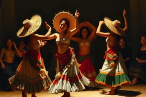
Igorot
Igorot
Indigenous tribes from the Cordillera region of the Philippines.
Banaue Rice Terraces
Banaue Rice Terraces
An ancient farming structure, UNESCO World Heritage Site, known as the 'Eighth Wonder'.
Mining in Benguet
Mining in Benguet
Signup and view all the flashcards
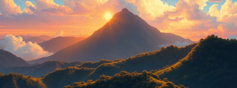
Mount Pulag
Mount Pulag
Signup and view all the flashcards
Cordillera's National Parks
Cordillera's National Parks
Signup and view all the flashcards
Climate of Cordillera
Climate of Cordillera
Signup and view all the flashcards
Land Area of CAR
Land Area of CAR
Signup and view all the flashcards
Abra Cuisine
Abra Cuisine
Signup and view all the flashcards
Apayao Cuisine
Apayao Cuisine
Signup and view all the flashcards
Benguet Cuisine
Benguet Cuisine
Signup and view all the flashcards
Kalinga Delicacies
Kalinga Delicacies
Signup and view all the flashcards
Geography of Abra
Geography of Abra
Signup and view all the flashcards
Population of Abra
Population of Abra
Signup and view all the flashcards
How to get to Abra
How to get to Abra
Signup and view all the flashcards
Languages in Abra
Languages in Abra
Signup and view all the flashcards
Tumuyoc Falls
Tumuyoc Falls
Signup and view all the flashcards
Laroy Falls
Laroy Falls
Signup and view all the flashcards
Buaya Caves
Buaya Caves
Signup and view all the flashcards
Lubo Rice Terraces
Lubo Rice Terraces
Signup and view all the flashcards
Apayao Geography
Apayao Geography
Signup and view all the flashcards
Apayao Climate
Apayao Climate
Signup and view all the flashcards
Dupag Rock Formation
Dupag Rock Formation
Signup and view all the flashcards
Bayugao Falls
Bayugao Falls
Signup and view all the flashcards
Lussok Cave
Lussok Cave
Signup and view all the flashcards
Gololan Falls
Gololan Falls
Signup and view all the flashcards
Abulog/Apayao River
Abulog/Apayao River
Signup and view all the flashcards
Benguet Province
Benguet Province
Signup and view all the flashcards
Subtropical Highland Climate
Subtropical Highland Climate
Signup and view all the flashcards
Population of Benguet
Population of Benguet
Signup and view all the flashcards
Ethnolinguistic Groups in Benguet
Ethnolinguistic Groups in Benguet
Signup and view all the flashcards
Kennon Road
Kennon Road
Signup and view all the flashcards
Mt. Pulag
Mt. Pulag
Signup and view all the flashcards
Asin Hot Spring
Asin Hot Spring
Signup and view all the flashcards
Rocky Wall of Beauties
Rocky Wall of Beauties
Signup and view all the flashcards
Badi Falls
Badi Falls
Signup and view all the flashcards
Shamsham Falls
Shamsham Falls
Signup and view all the flashcards
Baguio City
Baguio City
Signup and view all the flashcards
Geography of Baguio
Geography of Baguio
Signup and view all the flashcards
Bontoc Museum
Bontoc Museum
Signup and view all the flashcards
Maligcong Rice Terraces
Maligcong Rice Terraces
Signup and view all the flashcards
Paradise Falls
Paradise Falls
Signup and view all the flashcards
Mt. Kalawitan
Mt. Kalawitan
Signup and view all the flashcards
Tagpeo Falls
Tagpeo Falls
Signup and view all the flashcards
Siblaw Taraw Lake
Siblaw Taraw Lake
Signup and view all the flashcards
Mt. Mog-ao
Mt. Mog-ao
Signup and view all the flashcards
Study Notes
Cordillera Administrative Region (CAR)
- CAR is a region in northern Luzon, Philippines
- Spanish conquistadors named the region "Cordillera"
- The region is also home to the Igorot indigenous tribes.
- CAR is rich in mineral reserves, including gold, copper, silver, zinc, sand, gravel, and sulfur
- Mining is concentrated in Benguet
- Agriculture and small-scale production are significant economic activities.
- CAR is popular for tourism due to its scenic landscapes and cool environment.
- Banaue Rice Terraces in Ifugao is a UNESCO World Heritage Site.
- The region contains numerous tourist attractions including the Sumaguing Cave, mummy caves, Mount Pulag (highest mountain in Luzon), Mount Data, and Balbalasang-Balbalan.
Land Area
- The total land area of CAR is 28,228.83 km² (10,900 sq mi).
Objectives (for students)
- Understand the historical, geographic, demographic, and cultural aspects of CAR
- Study the various provinces in CAR.
- Identify and describe major tourist destinations.
Studying That Suits You
Use AI to generate personalized quizzes and flashcards to suit your learning preferences.