Podcast
Questions and Answers
What does external forcing refer to in coastal systems?
What does external forcing refer to in coastal systems?
Weather, water fall, climate
Which type of coastlines are known as collision coasts?
Which type of coastlines are known as collision coasts?
- Coastlines that are sitting on the boundary of a tectonic plate (correct)
- Coastlines that are in the middle of a tectonic plate
- Coastlines that do not experience storm waves
- Coastlines found on flat coastal plains
Which of the following is NOT a type of sea level change?
Which of the following is NOT a type of sea level change?
- Ecstatic
- Volcanic (correct)
- Both A and B
- Isostatic
What is the average wave climate in Sydney?
What is the average wave climate in Sydney?
The top of a wave is called a __________.
The top of a wave is called a __________.
The vertical distance between the top of the crest and the bottom of the trough is called wave __________.
The vertical distance between the top of the crest and the bottom of the trough is called wave __________.
Wave height increases as waves move from deep to shallow water.
Wave height increases as waves move from deep to shallow water.
What phenomenon occurs when waves bounce off a structure?
What phenomenon occurs when waves bounce off a structure?
What are the three components of rip currents?
What are the three components of rip currents?
Which type of tides occur when the tide range is less than 2m?
Which type of tides occur when the tide range is less than 2m?
Rip currents always flow towards the shore.
Rip currents always flow towards the shore.
Flashcards are hidden until you start studying
Study Notes
Coastal Systems Controls
- External forcing includes factors such as weather, precipitation, and climate changes impacting coastlines.
Morphodynamic Systems
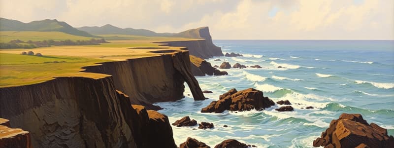
- Geology is the primary control on coastlines, linked to plate tectonics.
- Collision coasts (e.g., mountainous areas) exhibit poorly developed beaches.
- Trailing edge coasts (e.g., East Coast of South America, Australia) feature flat coastal plains.
- Geological controls also incorporate regional sediment such as bedrock, sand, and clay.
Sea Level
- Sea level serves as a secondary control influenced by climate change.
- The Quaternary period experienced significant sea level changes:
- Last glacial maximum occurred 18,000 years ago, with sea levels about 120 meters lower than now.
- Rapid sea level rise concluded around 6,500 years ago (post-glacial marine transgression).
- Sea level changes are categorized into:
- Eustatic (global) changes, influenced by melting ice.
- Isostatic (local) changes, resulting from land elevation variations.
Wave Climate
- Wave climate is a tertiary control affected by atmospheric conditions.
- Waves lead to sand transport processes:
- Storm waves promote offshore erosion.
- Normal waves facilitate accretion and deposition.
- Example: Sydney experiences an average wave height of 1.6 meters and wave periods of 8 seconds, primarily from the southeast.
Daily Processes
- Daily processes (waves, currents, tides, sediment transport) represent the fourth control on coastlines, influencing sand movement.
Wave Theory
- Waves are disturbances that travel through water; particle movement occurs in circular patterns.
- Crest: Topmost part of the wave.
- Trough: Lowest part of the wave.
- Key wave parameters:
- Wavelength (L): Distance between consecutive crests.
- Wave height (H): Vertical distance from crest to trough.
- Wave period (T): Time interval between waves passing a point.
- Wave depth (h): Depth from the mean surface to the bottom.
Wave Behavior
- As waves transition from deep to shallow water:
- Water depth decreases, causing shortening of wavelength and decreased speed.
- Wave height increases while wave period remains unchanged.
Wave Generation
- Wind initiates wave formation; both wind velocity and duration influence wave height and period.
- Significant wave height (Hs) is determined by the highest third of waves.
Types of Waves
- Waves are classified based on period and energy spectrum:
- Gravity waves: Common waves with periods between 1-30 seconds.
- Wind waves ('sea'): Locally generated, short periods (2-8 seconds).
- Swell waves: Consistent, long-distance traveling waves with large wavelengths.
Wave Shoaling
- Waves shoal when water depth equals half their wavelength (L/2), becoming asymmetric due to wave refraction influenced by topography.
Types of Breaking Waves
- Plunging: Occurs on steep beaches and involves a rapid break at one spot.
- Spilling: Characterized by slower breaks on gentle slopes; safer due to dissipated energy.
- Surging: Small waves that rapidly flow up and down the beach, resembling tsunamis.
- Collapsing: Dangerous, steep waves with long periods.
Wave Reflection
- Known as 'clapotis,' occurs near rocky areas, headlands, and steep beaches where waves bounce off structures and create turbulent, erosive effects.
Nearshore Currents
- Surf zone currents are influenced by wave breaking intensity and height.
- Longshore currents develop along coastlines due to the angles of wave approach, facilitating sediment transport at flow speeds of 0.3 - 0.6 ms^-1.
Rip Currents
- Strong, narrow currents flowing seaward, found in channels between sandbars.
- Characterized by pulsating flow and often the fastest at low tide.
- Components include feeder current, rip neck, and rip head, contributing to nearshore circulation.
Types of Rip Currents
- Channelized rips: Long-lasting, found in deep channels, appearing as "green gaps" on beaches.
- Boundary rips: Near structures, generally flow faster and further offshore due to topography.
- Flash rips: Brief and variable, influenced by wave characteristics, bubbly in appearance.
- Mega rips: Form during storms, causing significant beach erosion.
Tides
- Tides are periodic changes in water level caused by gravitational forces from the earth-moon-sun system, typically resulting in two high and two low tides daily.
Tide Range
- Tide range measures the difference between high and low tide levels and varies based on lunar positions.
- Types of tides:
- Microtidal: Tide range < 2 meters.
- Mesotidal: Tide range 2-4 meters.
- Macrotidal: Tide range > 4 meters.
- Tide range is influenced by water depth and the shape of ocean basins and coastlines.
Studying That Suits You
Use AI to generate personalized quizzes and flashcards to suit your learning preferences.


