Podcast
Questions and Answers
What type of graph is used to represent average precipitation in a climograph?
What type of graph is used to represent average precipitation in a climograph?
- Pie chart
- Scatter plot
- Bar graph (correct)
- Line graph
Which factor has the biggest effect on climate according to the provided details?
Which factor has the biggest effect on climate according to the provided details?
- Global winds
- Ocean currents
- Humidity levels
- Insolation (correct)
What is a necessary condition for accurately comparing two climographs?
What is a necessary condition for accurately comparing two climographs?
- They must have the same scales on the vertical axes. (correct)
- They must show the same number of months.
- They must have identical temperatures.
- They must represent similar geographic locations.
Why does Vancouver have a warmer climate than Edmonton despite being at similar latitudes?
Why does Vancouver have a warmer climate than Edmonton despite being at similar latitudes?
Which of the following best describes the relationship between latitude and insolation?
Which of the following best describes the relationship between latitude and insolation?
Flashcards
What is a climograph?
What is a climograph?
A graph that shows the average temperature and precipitation of a location over a year.
What is insolation?
What is insolation?
The amount of sunlight a place receives, mostly determined by latitude.
How do global winds affect climate?
How do global winds affect climate?
Global wind patterns can influence both short-term weather and long-term climate patterns.
How do ocean currents affect climate?
How do ocean currents affect climate?
Signup and view all the flashcards
What is crucial when comparing two climographs?
What is crucial when comparing two climographs?
Signup and view all the flashcards
Study Notes
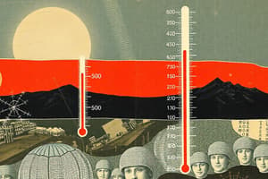
Climatographs
- A graph showing average temperature and precipitation of a location over a year
- Average precipitation is plotted as a bar graph (like raindrops collected in a bucket). Measured in mm
- Average temperature is plotted as a line graph. Measured in °C
- For comparison, the vertical axes of two climatographs must have the same scale
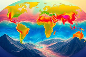
Factors Affecting Climate
- Insolation: Most related to latitude. Areas near the equator receive more direct sunlight, resulting in hotter climates.
Global Winds
- Patterns can determine short-term weather and long-term patterns.
- Chicago is known as "The Windy City"
Ocean Currents
- Have a moderating effect on climate (e.g., Vancouver has a warmer climate than Edmonton, despite being at similar latitudes).
Studying That Suits You
Use AI to generate personalized quizzes and flashcards to suit your learning preferences.