Podcast
Play an AI-generated podcast conversation about this lesson
Download our mobile app to listen on the go
Get App
Questions and Answers
What discipline does Geography draw from, according to the text?
What discipline does Geography draw from, according to the text?
- Botany
- Sociology
- Mathematics (correct)
- Astronomy
Which of the following is NOT mentioned as a discipline that Geography draws from?
Which of the following is NOT mentioned as a discipline that Geography draws from?
- Economics
- Political Science
- Physics (correct)
- Biology
In which historical period was the House of Wisdom known for its contributions to cartography and other sciences?
In which historical period was the House of Wisdom known for its contributions to cartography and other sciences?
- The Age of Exploration
- The Industrial Revolution
- The Abbasid Caliphate (correct)
- The Renaissance
Which discipline would be most relevant for interpreting remote sensing images in Geography?
Which discipline would be most relevant for interpreting remote sensing images in Geography?
Signup and view all the answers
Which of the following sciences is NOT typically associated with the field of cartography?
Which of the following sciences is NOT typically associated with the field of cartography?
Signup and view all the answers
Flashcards are hidden until you start studying
Study Notes
- GIS (Geographic Information System) is a technological innovation in the field of geography and analysis, enabling users to visualize data and identify patterns and relationships.
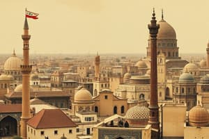
- Baghdad is a city located in Iraq, serving as the capital of the Abbasid Caliphate in the past.
- GIS has significantly impacted the field of cartography, which involves the creation of maps and charts, by revolutionizing map making and spatial analysis.
- Geography is a multidisciplinary science, drawing knowledge from various other fields such as economics, political science, history, biology, geology, mathematics, and computer science.
- The Earth is the primary focus of geography, which explores its physical and cultural features.
- GIS has transformed map making and spatial analysis, making it an essential tool for geographers and analysts.
- Baghdad holds historical significance as the former capital of the Abbasid Caliphate.
- Geography overlaps with various sciences and social sciences to provide a comprehensive understanding of the world.
- GIS is a powerful tool that allows users to analyze and visualize data to gain insights and make informed decisions.
- Cartography is an essential part of geography, used to represent the Earth's features and relationships in a visual format.
Studying That Suits You
Use AI to generate personalized quizzes and flashcards to suit your learning preferences.