Podcast
Questions and Answers
What is a key advantage of geostationary satellites?
What is a key advantage of geostationary satellites?
- They operate at lower altitudes for better detail.
- They provide global coverage of weather systems.
- They continuously monitor the same area in real-time. (correct)
- They capture infrared imagery for detailed temperature analysis.
Which of the following cloud formations is most associated with thunderstorms?
Which of the following cloud formations is most associated with thunderstorms?
- Stratus clouds
- Cumulonimbus clouds (correct)
- Nimbostratus clouds
- Cirrus clouds
Why is infrared satellite imagery important in weather analysis?
Why is infrared satellite imagery important in weather analysis?
- It shows detailed wind patterns.
- It helps identify cloud cover types and density.
- It measures precipitation levels directly.
- It indicates cloud top temperatures and heights. (correct)
Which factor is crucial for pilots when evaluating cloud cover?
Which factor is crucial for pilots when evaluating cloud cover?
What do cooler cloud tops appearing whiter on infrared images indicate?
What do cooler cloud tops appearing whiter on infrared images indicate?
What is the primary function of polar-orbiting satellites in weather monitoring?
What is the primary function of polar-orbiting satellites in weather monitoring?
How do pilots utilize both radar and satellite data?
How do pilots utilize both radar and satellite data?
What can certain cloud formations, like spiraling bands, indicate?
What can certain cloud formations, like spiraling bands, indicate?
What adjustments might pilots make based on weather data analysis?
What adjustments might pilots make based on weather data analysis?
What is the result of effective use of satellite imagery and radar data?
What is the result of effective use of satellite imagery and radar data?
Radar imagery is primarily used in aviation for the detection of precipitation and the tracking of its movement.
Radar imagery is primarily used in aviation for the detection of precipitation and the tracking of its movement.
The most commonly used type of weather radar in aviation is known as a "Doppler" radar, which can only detect the location and intensity of precipitation.
The most commonly used type of weather radar in aviation is known as a "Doppler" radar, which can only detect the location and intensity of precipitation.
A "Hook Echo" on radar imagery is a distinct feature that may indicate the presence of a mesocyclone or even a potential tornado, prompting immediate flight rerouting.
A "Hook Echo" on radar imagery is a distinct feature that may indicate the presence of a mesocyclone or even a potential tornado, prompting immediate flight rerouting.
Satellite imagery provides a more detailed view of weather patterns than radar imagery, allowing pilots to pinpoint exact cloud formations.
Satellite imagery provides a more detailed view of weather patterns than radar imagery, allowing pilots to pinpoint exact cloud formations.
Doppler velocity is a feature on radar imagery that gives information about changes in wind speed and direction within a small area in the atmosphere, a phenomenon known as wind shear.
Doppler velocity is a feature on radar imagery that gives information about changes in wind speed and direction within a small area in the atmosphere, a phenomenon known as wind shear.
While both radar and satellite imagery are crucial in aviation, they are completely independent of each other, providing distinct data sets with no overlap.
While both radar and satellite imagery are crucial in aviation, they are completely independent of each other, providing distinct data sets with no overlap.
The intensity of precipitation on radar imagery is represented by a color coding system, where lighter colors indicate heavier precipitation and darker colors represent lighter precipitation.
The intensity of precipitation on radar imagery is represented by a color coding system, where lighter colors indicate heavier precipitation and darker colors represent lighter precipitation.
Satellite imagery, being a space-based system, is less affected by atmospheric conditions compared to ground-based radar systems.
Satellite imagery, being a space-based system, is less affected by atmospheric conditions compared to ground-based radar systems.
Interpreting radar imagery is a complex task requiring specialized training, while understanding satellite imagery is relatively straightforward for anyone to grasp.
Interpreting radar imagery is a complex task requiring specialized training, while understanding satellite imagery is relatively straightforward for anyone to grasp.
Pilots primarily rely on radar imagery for long-distance flight planning, while satellite imagery is more useful for short-range decisions and local weather updates.
Pilots primarily rely on radar imagery for long-distance flight planning, while satellite imagery is more useful for short-range decisions and local weather updates.
What is the primary advantage of using geostationary satellites in weather monitoring, and how does it differ from polar-orbiting satellites?
What is the primary advantage of using geostationary satellites in weather monitoring, and how does it differ from polar-orbiting satellites?
How do cloud types and patterns, as observed on satellite imagery, contribute to the identification of approaching weather systems?
How do cloud types and patterns, as observed on satellite imagery, contribute to the identification of approaching weather systems?
What is the significance of cloud top temperatures, as revealed by infrared satellite imagery, in weather analysis?
What is the significance of cloud top temperatures, as revealed by infrared satellite imagery, in weather analysis?
Why is it essential to combine radar and satellite data in aviation weather analysis?
Why is it essential to combine radar and satellite data in aviation weather analysis?
How do pilots utilize satellite imagery to ensure flight safety, and what adjustments might they make based on their analysis?
How do pilots utilize satellite imagery to ensure flight safety, and what adjustments might they make based on their analysis?
What are the distinct strengths of geostationary and polar-orbiting satellites in weather monitoring, and how do they complement each other?
What are the distinct strengths of geostationary and polar-orbiting satellites in weather monitoring, and how do they complement each other?
How does infrared satellite imagery enhance the accuracy of weather forecasting, particularly in relation to cloud top temperatures?
How does infrared satellite imagery enhance the accuracy of weather forecasting, particularly in relation to cloud top temperatures?
What role do cloud formations and patterns play in identifying weather systems and predicting their movement?
What role do cloud formations and patterns play in identifying weather systems and predicting their movement?
How do pilots use satellite imagery to distinguish between VFR (Visual Flight Rules) and IFR (Instrument Flight Rules) conditions?
How do pilots use satellite imagery to distinguish between VFR (Visual Flight Rules) and IFR (Instrument Flight Rules) conditions?
What is the ultimate goal of combining radar and satellite data in aviation weather analysis, and how does it impact flight operations?
What is the ultimate goal of combining radar and satellite data in aviation weather analysis, and how does it impact flight operations?
Flashcards are hidden until you start studying
Study Notes
Radar Imagery in Aviation
- Radar stands for Radio Detection and Ranging; it detects and tracks objects, especially weather formations.
- Radar systems emit radio waves that return echoes to determine the location and intensity of precipitation.
- Pilots use radar images to make informed decisions regarding weather-related flight hazards.
- Types of radar images in aviation include base reflectivity, composite reflectivity, and Doppler velocity, each providing different storm data.
- Echoes on radar images represent precipitation, with colors indicating intensity; blue shows light precipitation, while red indicates severe conditions.
- Shapes like hook echoes may signal tornadoes, while bow echoes suggest strong winds.
- Radar data can be delayed; it is crucial to obtain the most current information from multiple sources, including air traffic control.
- Integration with other weather sources such as satellite imagery, PIREPs, and ground observations is essential for comprehensive weather analysis.
- Radar imagery significantly enhances flight safety by aiding pilots in avoiding adverse weather conditions.
Satellite Imagery for Pilots
- Satellite imagery includes infrared, visible, and water vapor types, each providing unique weather insights.
- Infrared imagery identifies cloud heights and thickness, assisting pilots in making altitude decisions.
- Visible satellite imagery captures daytime cloud formations, while water vapor imagery displays upper-level moisture and jet streams.
- Satellites equipped with sensors capture data at specific energy wavelengths and transmit it to ground stations for processing.
- Interpreting satellite data supports thorough flight planning and proactive weather management.
- Recognizing cloud formations through shades and patterns enhances a pilot's situational awareness.
- Examples of cloud types include cirrus, cumulus, and cumulonimbus, each indicating varying atmospheric stability.
- Case studies highlight the value of satellite imagery; pilots can adjust flight routes based on observed weather developments, improving safety.
- Limitations of satellite imagery include timeliness, resolution issues, and blind spots during night or in less-covered regions.
- Pilots should always cross-reference satellite data with other weather reports for a complete understanding of flying conditions.
Importance of Combining Data Sources
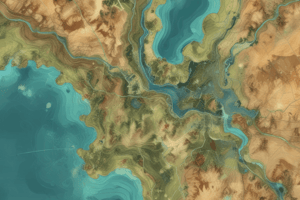
- Two types of weather satellites exist: geostationary (fixed position, real-time data) and polar-orbiting (global coverage, detailed images).
- Satellite images help identify cloud formations and track weather systems effectively.
- Infrared imagery is useful for determining cloud top temperatures, indicating potential storm activity.
- Main features to monitor in satellite imagery include cloud cover for VFR/IFR conditions, specific cloud types for storm detection, and cooler cloud tops indicating dangerous weather.
- The combination of radar and satellite data allows pilots to accurately assess weather conditions and adjust flight plans proactively for safety.
Radar Imagery in Aviation
- Radar, or Radio Detection and Ranging, detects and tracks weather formations by emitting radio waves that reflect off objects.
- Pilots utilize radar imagery for real-time insights into weather conditions like thunderstorms and turbulence.
- Types of radar images include base reflectivity, composite reflectivity, and Doppler velocity, each providing distinct information about storm dynamics.
- Echoes on radar images represent precipitation, with color-coding indicating intensity from light (blue) to severe (red).
- Recognizing shapes and patterns, such as hook echoes (signifying potential tornadoes) and bow echoes (indicating strong winds), is essential for decision-making in flight.
- Radar data may be delayed in processing; thus, pilots need current data and must cross-reference with air traffic and weather updates.
- Integration of radar with satellite imagery, PIREPs, and ground observations offers a comprehensive weather understanding for better flight planning.
Satellite Imagery for Pilots
- Satellite imagery comes in various forms: infrared (measuring cloud heights), visible (daytime cloud structure), and water vapor (upper-level moisture).
- Satellites equipped with sensors capture data on specific energy wavelengths and relay it back to ground stations for analysis.
- Understanding satellite images aids in comprehensive flight planning and the identification of weather patterns, improving pilot readiness against turbulence and adverse conditions.
- Cloud formations in satellite images provide critical insights into the atmosphere's state; types include cirrus, cumulus, and cumulonimbus.
- Real-time tracking of weather developments via satellite imagery allows pilots to adjust flight paths to avoid dangerous weather phenomena.
- Limitations such as image resolution, timeliness, and potential blind spots during nighttime or areas with sparse satellite coverage necessitate careful interpretation.
Interpreting Radar and Satellite Data
- Both radar and satellite imagery complement each other to give pilots an extensive view of weather phenomena affecting aviation.
- Radar imagery primarily highlights precipitation location, movement, and intensity to identify hazardous weather like thunderstorms and heavy rain.
- Doppler radar is commonly used in aviation for detecting precipitation motion and intensity, vital for understanding wind shear.
- Key features to look for in radar images include:
- Echoes indicating precipitation intensity through color coding.
- Hook echoes indicating the presence of tornadic activity.
- Doppler velocity providing wind shear information.
- Combining insights from radar and satellite data enhances situational awareness, ensuring better flight safety and planning.
Radar Imagery in Aviation
- Radar stands for Radio Detection and Ranging, enabling detection and tracking of objects like weather formations.
- Emits radio waves that bounce off objects, analyzing echoes to determine precipitation location and intensity.
- Pilots utilize radar imagery for real-time insights into weather conditions affecting flights, such as thunderstorms and turbulence.
- Types of radar images in aviation include:
- Base reflectivity: Shows the intensity of precipitation from the ground level.
- Composite reflectivity: Combines multiple levels of reflectivity for a broader view.
- Doppler velocity: Measures the motion of objects, crucial for assessing wind shear and storm dynamics.
- Radar echoes indicate precipitation intensity, with color coding (blue for light, red for severe) aiding interpretation.
- Identifying key radar features such as:
- Echoes: Areas of precipitation.
- Hook echoes: Indicator of potential tornadoes or mesocyclones.
- Doppler velocity: Reveals wind speed and direction changes.
Satellite Imagery in Aviation
- Satellite imagery is crucial for predicting weather patterns, enhancing pilot decision-making.
- Types of satellite imagery:
- Infrared: Identifies cloud heights and thickness, essential for altitude considerations.
- Visible: Provides daytime views of cloud formations.
- Water vapor: Shows moisture content and jet streams, influencing turbulence.
- Satellites capture data using sensors tuned to specific energy wavelengths, relaying information to ground stations for processing.
- Importance of satellite data includes aiding comprehensive flight planning and identifying cloud formations.
- Key features in satellite imagery:
- Cloud cover: Determines flying conditions (VFR vs. IFR).
- Cloud types/patterns: Identifies weather systems like cyclones or hurricanes.
- Infrared imagery: Cooler cloud tops may indicate severe weather potential.
Integrating Radar and Satellite Data
- Both radar and satellite data present complementary perspectives on weather influences affecting aviation.
- Radar focuses on precipitation, while satellite imagery gives a broader view of atmospheric conditions.
- Understanding and interpreting both tools enhances the ability to plan flights proactively.
- Pilots should cross-reference these data sources to form a comprehensive weather picture, leading to better decision-making regarding route adjustments and altitude changes.
- Effective interpretation of meteorological data contributes to flight safety and operational efficiency.
Studying That Suits You
Use AI to generate personalized quizzes and flashcards to suit your learning preferences.